This year our annual trip to the Canadian Wilderness took us back to Nakina Ontario. Nakina is a paddling (and fishing) paradise with many wilderness route options ranging from whitewater rivers to huge scenic lakes. Despite this, it is rarely paddled.
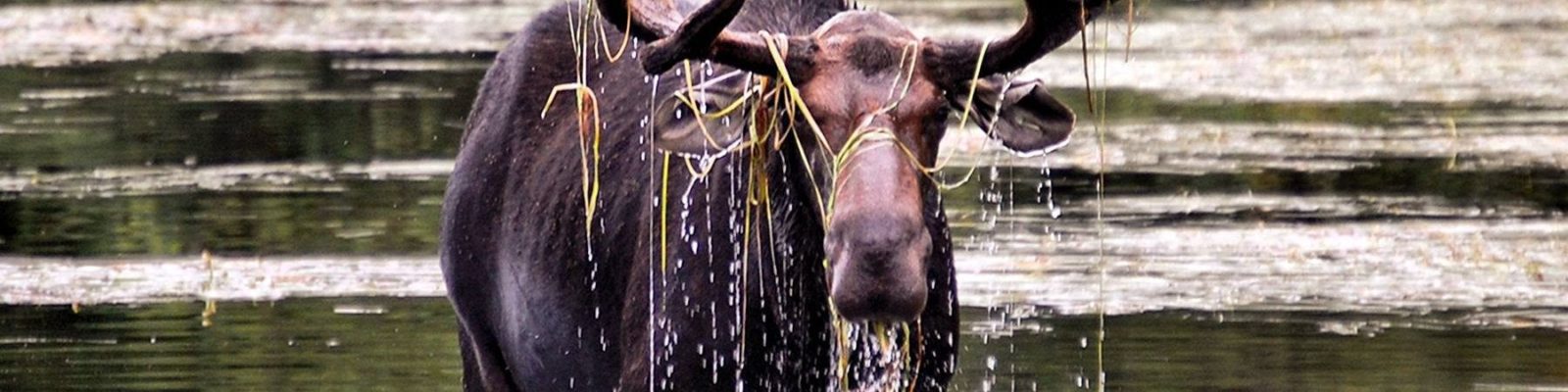
Our last trip in the region had been filled with rain and moose. This year we had very little of either. Our route took us down 3 of the major waterways in the area (the Ogoki, Kap, and Little Current). After all that downriver, we had to somehow return to the road. The usual method involves a float plane. We choose to travel up the Esnagami River, and then crash through the woods to a logging cut which then accessed a road. For the entire trip there was a bit of uncertainty about this last stretch.
We set off on Aug. 28th. Our starting point required a somewhat lengthy shuttle from Nakina. Kate once again was a good sport and crammed in the back “seat” of my Tacoma to make room for our shuttle driver.
The Ottertail was a small river surrounded by low marshes. Our sky was overcast, and now and then we would feel a light drizzle.

Starting out on the Ottortail
Around lunch time we made it to the Ogoki River. The Ogoki at this point was similar to the Ottertail, but much wider. We stopped for lunch on a rare rock outcropping.

Lunch on the Ogoki
As we made our way down the Ogoki, the shoreline alternated between low marshes and rocky ridges. There was little to break up the day, and we made good time.
Our tentative plan was to shoot for Amy falls before making camp. The falls were spectacular. We landed on the shore opposite the portage to crawl around on the rocks and view the falls.

Amy Falls on the Ogoki

Portraits at Amy Falls

When we paddled across to the portage we met a group of three people. They were camped on the downstream side of the portage, and had come up the entire river over the last 40 days. In a motor boat! They were conducting a survey of river sturgeon, and were in the processes of preparing the portage to drag their boat across.
We talked to them for awhile, and then continued on our way. After another 5 miles, we found a flat rock next to a rapids to make camp on. We enjoyed a clear night, and had possibly my favorite animal encounter to date.

Ogoki Camp
The next day the Ogoki started to speed up. For much of the day we paddled easy but constant ripples and small rapids. The fast sections were separated by wide slow areas. The banks were mostly sandy, but the river was full of boulders.

Ogoki River
We made it to Ogoki Lake by around 3:30. Ogoki is a large lake, and a wind had come up. The terrain had changed to more typical Canadian Shield bedrock. We made camp on an island about a third of the way across the lake. It took a little work to make a tent pad, but we were able to find a flat area sheltered from the wind. During the night the wind picked up, and in the morning it had shifted. It was now coming out of the NW, which made for a confused crosswind for much of the remaining lake crossing.

Ogoki Lake

Ogoki Campsite
We set off in the wind, bobbing around in the large waves. About half way to the narrow section leading to Kayedon lake it started to rain. It was a fairly unpleasant crossing. Once we were on Kayedon we stopped to bundle up a bit more, and then paddled the lake. A float plane landed in front of us, and taxied over to the fly-in camp on the lake.

Kayedon Lake
A small stream runs into Kayedon on the southern shore. We poked our way up it towards the long portage to Kapikotongwa Lake. Eventually the stream became shallow, and it was easier just to line up it.

Creek out of Kayedon

Towing the canoe
At the end of the creek we paddled a small lake and then found the portage. The portage was in good shape, and fairly dry. Areas of the trail were full of cranberries. Up to this point in the trip we had done very little portaging, and my legs needed a wake up call as we made our way up the first hill. We took a couple of breaks, but made it across. We ate lunch on Kapikotongwa lake.

Kapikotongwa lake after a hearty lunch
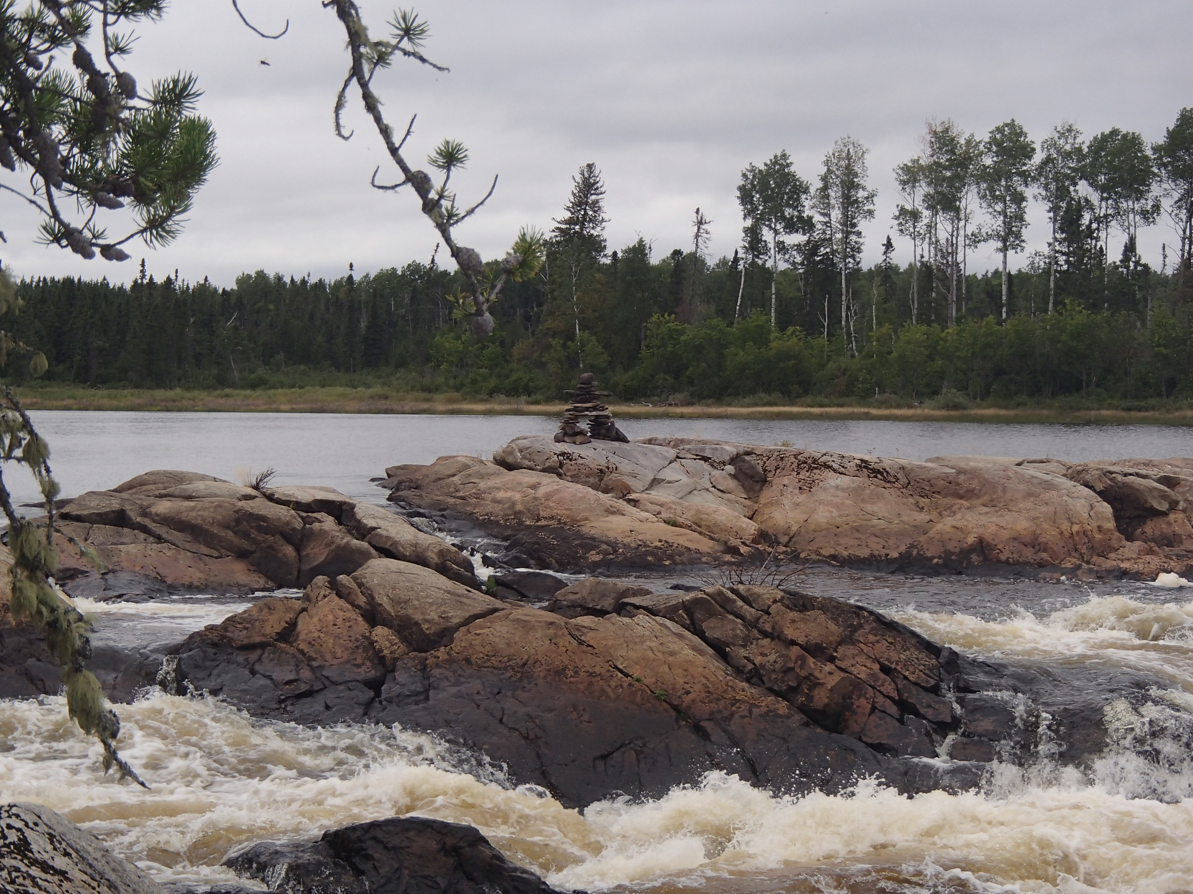
The next run of lakes on the way to Briarcliffe were stunning examples of Canadian Shield. We found the portage to Briarcliffe, complete with a portage sign (thanks Rob!). We set up camp on a rock point on the west end of the lake. There was an on and off light drizzle, and a strong wind. As the sun went down, it was downright chilly.

Briarcliffe camp
The next morning the clouds cleared after breakfast, and we had what might have been our best day of the trip. The remaining lakes where my favorite of the trip, especially Saga Lake. The narrow waterways connecting them often had high rocky sides and small swifts.
We had some fun easy white water once we were on the main river section, as well as some small swifts. We made it to the first marked rapids at lunch. The rapids/falls was much larger than I expected. We ate our lunch on a rock island with the rapids roaring on either side of us.

Small rapids on the Kapikotongwa

Rapids on the Kapikotongwa

At this point, I realized that I had accidentally left our camera on in my pocket, draining most of the batteries. I became very judicious with its use in order to save batteries for the Little Current. Unfortunately that meant not documenting much of our most scenic day. Anyone wishing to see the lower Kapikotongwa will just have to paddle it themselves.
We did not find portages on the Kapikotongwa. I may have had wrong information, or they may have been covered with trees from a blowdown. We made our way down the first two large rapids through a combination of lining, carrying through the woods, and some paddling. It was slow going, but I was grateful to be at the rivers edge with the scenery, not back in the woods walking around it.
After scouting the third marked rapids, we determined we could run it. It was a little more ledgeish than we usually paddle, but we ran it without incident (because we are a lone canoe, in remote areas we are pretty conservative about what we run).
After a long section of swift water we made it to Percy lake. We camped on a small island with a high rock overlooking both the lake and river. That night we watched swirling northern lights.

Percy Lake camp
We paddled Percy lake the next morning, and hit the Little Current River. The river was wide to start. After a couple miles the current picked up and the shore became lined with gravel bars. We ate lunch on one in the middle of a swift section of water.

Little Current lunch
We paddled on, and came to Betty Falls. What a scenic area! We found a good portage around the falls, and then lined the rapids at the bottom. I took the last photo of the trip We carried on to Canyon Falls, which was spectacular. I had the portage marked on the left. After much searching we came up empty handed, and decided to paddle back up to Betty falls and camp rather than start the long process of lining down the river. We had a great campsite and swam and relaxed.

Betty Falls

Last photo of the trip
The next day we paddled back down to Canyon falls, and while preparing to line found a portage on the opposite side of the river. From here on we found good portages. Often they were short, and involved brief paddles to connect them. The river was full of constant current between the larger rapids and falls.
We made it to Louella Falls at lunch time and ate at the top of the portage. We were about to conclude our downstream potion of the trip.
The Esnagami was fast and shallow where it hit the Little Current. After paddling and wading for awhile, it became apparent that it was not going to slow down. I cut a 12′ spruce pole, and we started pushing upstream. We were able to make decent progress poling, every now and again needing to get out and wade very shallow parts. Kate kept the bow in the right direction while I poled.
We traveled about 5 hard miles in 3 hours, and made camp at the first (last) marked rapids. It was a lovely campsite. We swam and read, and both easily fell asleep.
The next day it was back to poling. In spots the river was deeper, and travel easier. For brief sections we could both paddle (for anyone interested, I had a gps on for this section. When paddling we moved at about 3.5 mph, poling 2.5mph, and wading 1.5mph. Roughly). We also had a few larger rapids to negotiate. At around 11 we made it to our take out point. Our take out involved a short bushwack to a logging cut where we would eventually hit a winter trail that would take us to the road. It worked, but not without a lot of wandering around in an overgrown cut. We eventually found our trail, and made it to the road. We found the truck another mile or so down the road and drove it as close as we could to the winter trail. We were very thankful that our shuttle driver had left a bottle of water in the cab.
We backtracked to the river, figuring out our best path on the way. We ate one more lunch on the river, and then started the long carry to the truck. We took a couple of breaks, but all in all it wasn’t as bad as we thought it would be. We loaded up and made our way back to Nakina. On the drive we saw our only two moose of the trip.
Overall it was a great trip. We saw a very varied landscape, and the Kapikotongwa and Little Current where probably the most scenic days of paddling I’ve experienced. Our last two days where by far the hardest I’ve worked on a canoe trip, but allowed us to see some beautiful remote country without needing a float plane pick up.
As a final thought: Would I recommend coming up the Esnagami, and exiting through the logging cut? Probably not. It worked for us, and I’m glad we did it, but even with perfect weather it took almost everything we had.
-Quinn