This September Kate and I paddled the Weikwabinonaw River, in Ontario. The Weikwabinonaw has intrigued me for years, due mostly to its closeness, but I had never been able to find any good information about it. Since we did not have time this spring for our usual Canadian river trip, we thought we would take the short drive to the Northern Light lake area and give the Weikwabinonaw a try.
The river wildly exceeded my expectations. The river itself was very scenic, with beautiful rapids and rocks. Portages were in good shape, rougher than most BWCA/Quetico Portages, but much better than many farther north portages we have done.
In the last few years I have come to believe that that the best way to enjoy a trip is to do enough planning to make sure the trip is safe and feasible, and not much more. Why spend your time looking at someone else’s photos of the campsites and scenery of your route, when you can discover it for yourself? To me a large part of the appeal of wilderness tripping is the sense of exploration and discovery. When you reach a remote enough area, while you certainly aren’t the first person to travel that route, you can see it through that first traveler’s eyes. Knowing what is around every bend makes that feeling nearly impossible.
Although this trip was fairly short and through an area that is fairly easy to access, it served as an affirmation of the above ideas. The river was totally different than I had imagined, and the landscape offered many surprises each day. The route was easily doable in the four days we had. We must thank Robert at Red Pine Outfitters for his advice, hospitality, and for facilitation our car shuttle.

Starting out on Weikwabinonaw Lake. It was a classic shield country lake, filled with rocky points.

Looking up river, towards Jacob Lake.

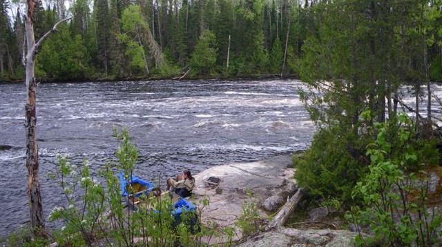
Start of the Weikwabinonaw River

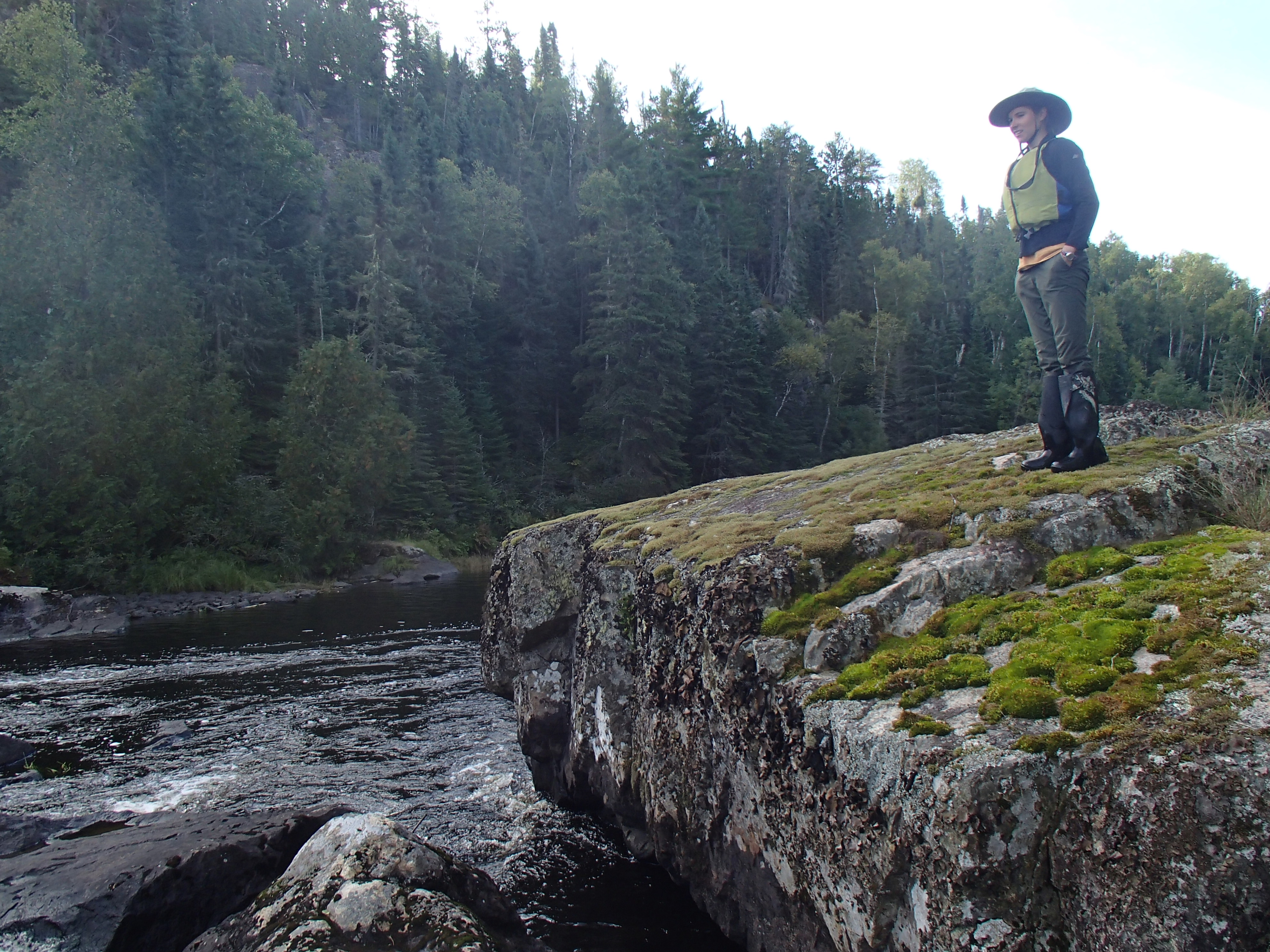
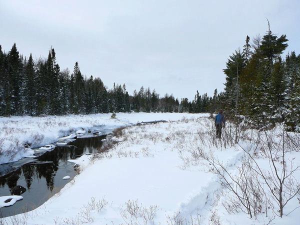
Kate, preparing to portage in a heavenly glow

Lunch stop on our first day.

Checking out the area around our camp on Koss Lake.

Cooking fire at our Koss lake site

Day 2 started in a heavy fog.


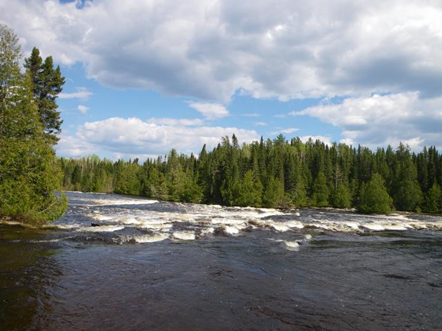
The start of a long rapids. With spring or even early summer water levels it would have been a fun and straight-forward run.

It rained on and off for our second morning.

A rough road crossed the river at a large rapids. There was a nice established campsite on the portage.

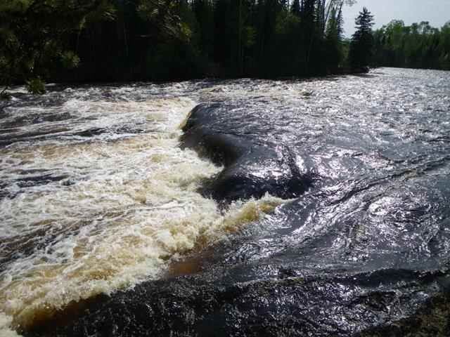
Looking at another larger set of rapids.


Kate, waiting patiently for me to be done looking at the large set of rapids.

We found a very scenic site on a small lake that the river passed through. After determining that we would stop for the day, Kate paddled the canoe around to a better landing spot.

Even at the “better landing”, the site was still difficult to access from the water.

The evening view from our site

Saying goodbye to our site in the morning

The last stretch of river was very scenic, with high rock faces and fast water.


Popping out into Northern Light Lake. We fought a strong wind for the rest of the day.

Lunch on Northern Light. We later found a serviceable campsite within a couple hour paddle of our take-out point.


The Grandpa Roy loop
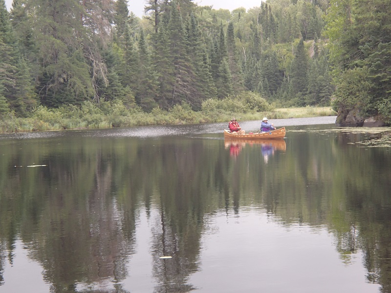
Last week Kate and I paddled one of our favorite day trips, the Grandpa Roy loop. The loop starts and ends at Trails’ End Campground, and takes you through Saganaga, Roy, Grandpa and Seagull Lakes. It is a very scenic route, with two small remote lakes sandwiched between two huge island filled lakes. The route sticks out to me because of how pleasant and beautiful the two portages from Roy to Grandpa and Grandpa the Seagull are. Walking them is one of the most enjoyable parts of the loop.
— Quinn

Entering the BWCA

Roy lake from the portage
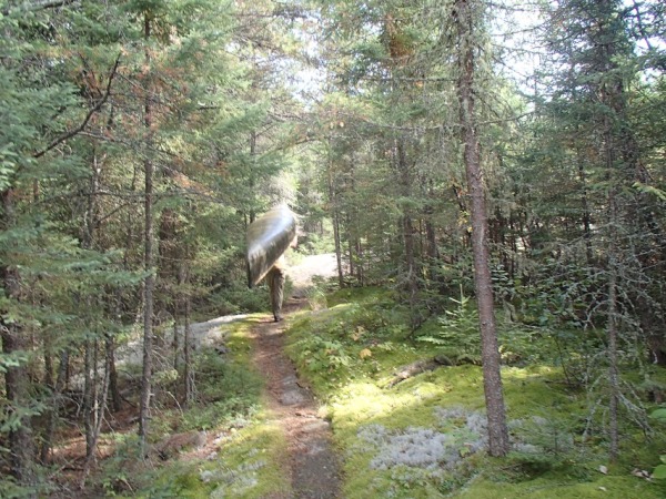
Strolling along the portage from Roy to Grandpa
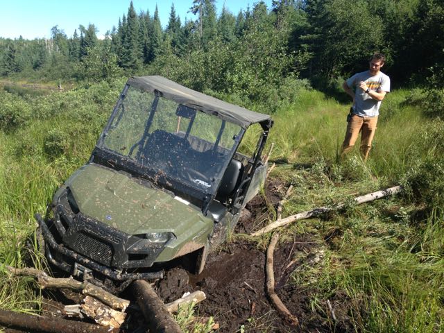
After a recent rain, Matthew, Jordan and I traveled to a top secret, highly classified stretch of river in search of some whitewater thrills. While not spring paddling by any means, there was just enough water to bump and scrape our way down.
— Quinn

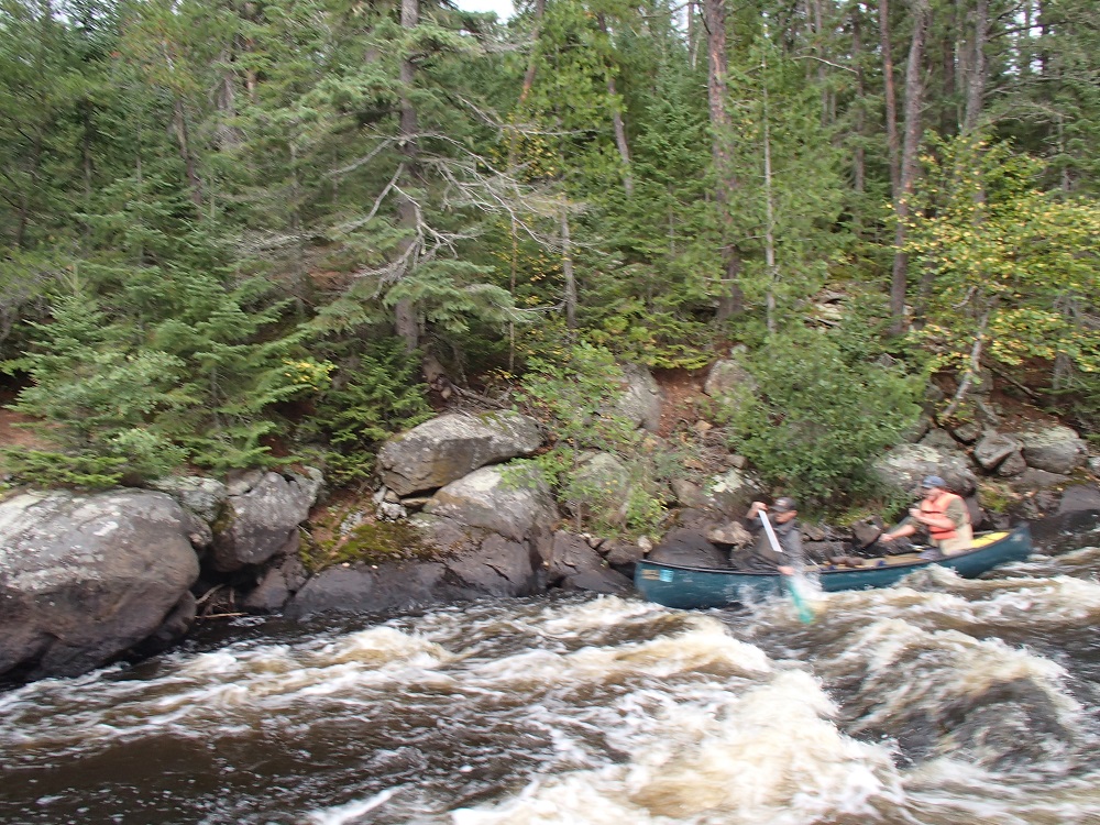
Heading down river

The Approach


DRAW MATTHEW, DRAW!!!!!!!!!!
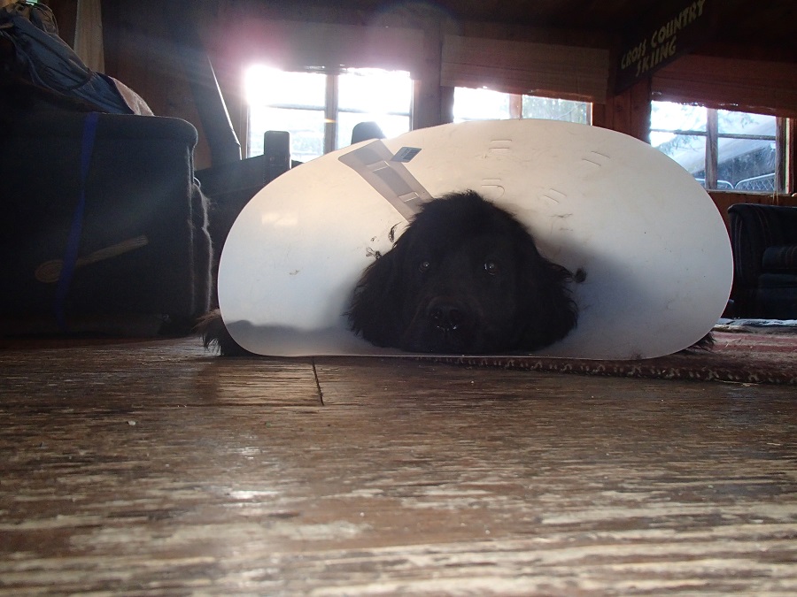
One of our long time staff members has spent the summer recovering from two knee surgeries. Limits on activity have forced Ruby to mostly work from home this summer. She now no longer needs to wear her cone, and is looking forward to the day when she can be inactive by choice, and not due to doctor’s orders.

Motivating her recovery is her desire to be able to go for a swim, and climb onto the couch.
— Quinn
This week Kate and I paddled a route from East Bearskin to the Vegetable Chain, at the same time running a shuttle for long-time guests Mark and Carol Morgen.
The Vegetable chain is a series of lakes that connect the east end of Crocodile Lake to the Shoe Lake Road. The Vegetables are unique in that they are outside the BWCA, but still non-motorized. They are also the only other access to Crocodile besides East Bearskin. The Vegetables to E. Bearskin is a great day trip, but involves a very long and impractical car shuttle To get around this problem, it was decided that Kate and I would paddle from East Bearskin and end at the Shoe Lake Road (the uphill but downwind direction) and Mark and Carol would come the opposite way. When Kate and I finished, Mark’s truck would be waiting for us.
— Quinn

South Bean Lake to East Bearskin

Lily pads on Crocodile

Meeting the Morgens at a portage

East end of Crocodile

Parsnip Lake on the Vegetable Chain
This year Kate and I returned to the Pickle Lake area for our June canoe trip. After last year’s trip, I assumed that there was never a rainy day around Pickle lake. Our weather was worse this year, as were the bugs. We drove to Pickle lake the day before, and stayed at the Lakeview Manor B&B, as we had the year before. Lynn from Lakeview took care of our vehicle shuttle.
We set off early on our first day, hoping to get ahead of the wind. We were not so lucky and made our way down the lake in a light rain and a heavy wind. We had 50 miles of Lake St.Joe to paddle, and it seemed unlikely we would be able to avoid getting wind-bound. The wind was better once the lake jogged west, but still required our full attention. The lake itself was scenic and full of rock outcroppings.
At 11:30 we came to a large section of lake that we could not safely cross in the wind. Luckily there was a nice place to camp. We warmed ourselves in our tent and killed time until dinner. No photos were taken the first day.
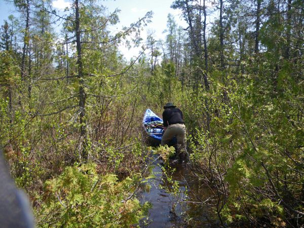
Day two we woke up at 4 AM. The wind was already strong. We were able to make our first crossing and head down the lake. The waves were very large, but the spacing between them was large and predictable. Around 11 we again came to another crossing that we were not comfortable with considering the wind. We decided to make our way into the bay and see if we could portage across the beginning of a large peninsula. The topo map had it marked as a wooded bog, so it seemed possible. Portaging wasn’t too bad, and it was nice to stretch our legs anyways. After our trip was over, I was amused to see a possible portage marked there in the Canoe Atlas of the Little North.
After portaging, the wind seemed to die down, and the sun came out. We ate a nice long lunch on a sand beach. We continued down the lake, still in large waves, but in better spirits due to the sun. We made camp on a large rock outcropping right before the lake jogs south.


Day three we again woke at 4 AM and paddled a large crossing. Once we begin heading west, we were treated to a light wind at our backs. We stopped after a few hours and ate breakfast on an island. The day was pleasant by the time we reached Johnston Bay. It took us a second to locate the entrance of the Cat River, but we were happy to be able to paddle right up the small swift at the mouth. We were greeted by the “Whale Rocks” referred to in the canoe atlas. By Blackstone lake there was on and off again light rain. The lake was very scenic, possibly my favorite of the trip. We met a party of motor boats from the fly-in camp on the lake, and shortly after set up camp on a very small site.

Day four saw us get off Blackstone and do our first planned portage of the trip. We were encouraged to find the portage in good shape. The rapids we carried the canoe around were full of water.
At the next portage it got a little tricky. The portage was marked on an island, but we were unable to find it. The island was very narrow, and there just weren’t too many places the trail could have been hiding. The portage was around a series of rapids (we were heading upstream) and we were able to crash through the woods to the top of one set and paddle to the bottom of the other.
Another trip through the woods saw us at the top of the next set looking to the third, which was around a separate small island. Some hard paddling put us on the small island, and we lined up the rapids and ate lunch. On our way to Roadhouse lake, and then Bamaji, we encountered a few more rapids, which may or may not have had portages around them, I can’t remember. The important part is that we got up them.
By the time we were to Bamaji the wind had really picked up out of the east. We headed N.W. across Bamaji sheltered by islands, until the time came to make a wide open crossing straight west. We made a poor choice and had a wild ride, but safely made it to the opposite shore. We paddled by a large fly in camp to a sheltered bay and made camp on a high rock. Soon after it started to rain heavily.


The morning of day five it was still raining. We made breakfast under the tarp and headed out. The wind was strong out of the west, and made our crossing of N. Bamaji difficult. I found the south shore of N. Bamaji very scenic. As we paddled across the lake, a float plane headed to the Slate Falls community landed right over us.
We were happy to find the first portage out of N. Bamaji. Once again, it was around a very full set of rapids. The next set of rapids was marked SLW, but we had to portage. Luckily there was an alright path. The last marked portage before Wesleyan lake may have existed, but the rapids seemed to be washed out, and some hard paddling got us to the top.
Wesleyan was again a very scenic lake, with high rocks and islands. The going was slow against a strong wind. On the north shore we could see the run out of what must have been a very large rapids, but we just didn’t have it in us to fight the wind and go look at it.
We arrived at the portage between Wesleyan and Kezik, known as the “Cat River Portage” and shown on my topo map. The portage had a lattice of logs constructed on it for dragging boats. It made walking much more difficult.
On Kezik Lake we had a favorable wind. We ate lunch and than headed east for the first time. Kezik was a sprawling lake full of islands and narrow channels. We paddled in a light mist.
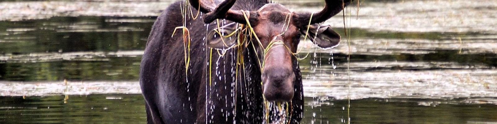
We came to the east end of Kezik a bit early to make camp. Our next section consisted of a very small creek, and I was unsure if we would be able to find a nice place to camp. We considered stopping early, but Kate leaned towards pushing on, so we did. The creek turned out to be one of my favorite parts of the trip. While I had though it might be swampy, it was generally it was high sided with small rock outcroppings. Paddling was easy, and a nice change of pace from the large lakes we’d been on. After around an hour we came to a great camp site on a small lake, next to a ledge filled rapids. A moose swam across the lake in front of us as we inspected the side. As the evening went on, we were treated to our fist patch of blue sky since our second day.


Day six was our last day of going up-stream. We broke camp and made our way up the creek, which was becoming narrower. The 350 m portage into the last lake on the creek was easy to find and in good shape, which was an encouraging sign for the long portages to come.
It took us a couple of passes to find to first of three long portages crossing the height of land into the Dobie river. Once on it, the 700m portage was flagged with a good trail, until we hit a swamp where it disappeared. After much dragging, cursing, and despair, we made it out to a small channel with took us to the next lake. The next portage, 800m, was high and dry and marked with old blazes. The last portage, marked 500m, was not apparent.
With a little scouting we were able to carry through a section of spruce forest and emerge at Dorothy Lake. On Dorothy we saw flagging at a likely spot to have replaced the missing 500m port, and wondered if maybe our information was out of date (we were not using the route to the Dobie shown in the canoe atlas, but instead a route apparently used by Camp Wabun).
We crossed Dorothy lake and finally were on the Dobie. The Dobie is small at this point, but with steady current. We ran some small riffles and had to lift over a log. Shortly after passing the Winter Rd we came to a large drop that we lined. We portaged river left around a long rapids well on its way to becoming a log jam. We made camp just above a small lake at a nice but unspectacular site.


On day seven we woke up to blue skies. It would be our first full day of good weather. We paddled across the small unnamed lake and then made our way down a long shallow set of rapids, often wading. On the next lake we paddled east into a strong wind. We took a 750m portage into Dobie lake. The port was in great shape, probably maintained by the fly in camp on the lake. We paddled Dobie, and ate lunch half-way down on an island. We ran two sets of rapids, one large that required some eddy scouting, and one straight forward set. We paddled a small lake, and then Hergott Lake.
After Hergott we found a small area we could camp at. We decided to paddle another little ways and see if there was better camping at the next portage. I had the portage on the left, but we eventually found it on the right. The rapids were impressive, but there was no good place to camp. We returned to the first site and made camp.


Day eight started with a short paddle and the portage we had found the day before. We padded until another large rapids, which we ran left. We took on some water at a small ledge. As we paddled across Lecky lake, the wind shifted to behind us. We ran a few easy riffles and ended up in Nanos lake, where the wind was no longer favorable. We ate lunch at Nanos. After Nanos we ran a couple SLWs and took a 600m portage around a powerful set of rapids. We ran a few bigger rapids, eddy scouting on the way down. We came to a rapids that Lynn had told us to be cautious of, where the Dobie makes a hairpin turn during a steep drop. We ran the top, working from eddy to eddy. After awhile we found a portage trail in an eddy. Below us we noticed a slopping rock campsite, with small eddy above it. We elected to portage to it, since missing the eddy would have had a high consequence. The site needed a little work, but sat at the edge of a massive section of the rapids. The water was deafening.


Day nine started with a long portage around the remaining rapids. It had rained all night, and the bugs were very bad. The remaining rapids on the Dobie were mostly easy straight shots. We entered the Otoskwin below Froats lake. Since we had paddled this stretch last year, it was interesting to compare water levels. The rapids this year seemed pushier and more confused. It rained most of the day. We were happy to take the long portage around the rapids above Bow lake, just to stretch our legs. Last year we had run and lined them, and I’m glad we did as there was no good view of the rapids or the campsite at their bottom from the portage.
We paddled Bow lake and them made camp on the portage around a big set of rapids. Last year we had arrived at this site mid-day and thought how nice it would be to camp there, so it was nice that it worked out this trip. It rained on and off through out the evening, and the bugs keep us inside our bug shelter.


Day ten was a beautiful sunny day. We ran the bottom of the rapids we were camped on, and continued towards Mud lake. The current was strong, and we made good time. We arrived at our last campsite from last year around 11:30. We knew that it would take nearly a half day to make it to our take-out, so we decided to camp and have a short day our last day. The bugs were bad, but a breeze kept them in check.


On day eleven it was overcast, but not raining. We paddled the last of the Otoskwin to Mud lake and made it to the take-out. We drove about halfway home, and stopped in Upsala for the night.
This trip presented many challenges, from Lake St Joe to missing portages to unbelievable bugs and hard rapids, but on day eleven I would have happily just kept going down the Otoskwin. We paddled a little bit of everything, giant lakes to tiny creeks, and saw a pronounced difference in the landscape after crossing the height of land. The total trip ended up at 11 days and about 210 miles, plus around 16 hours driving.
— Quinn
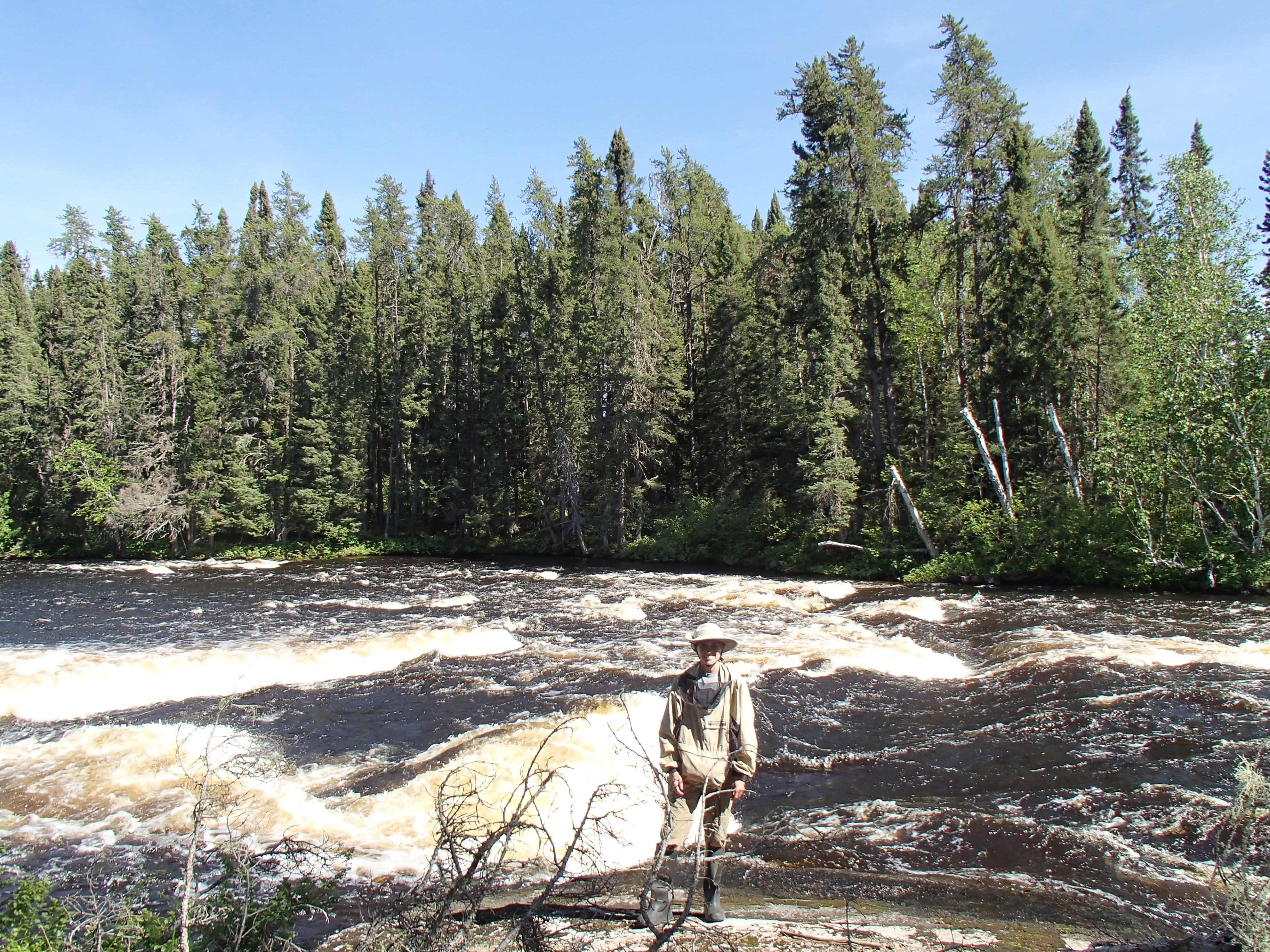
This spring our canoe trip took us to Pickle lake, Ontario. Pickle Lake is small town (about 300 people), and is the northern most town you can drive to in Ontario. Our route started at Stirland Lake, a 120 mile drive on the north rd from pickle lake, and ended at Mud Lake, about 20 miles out of town. On the drive to Pickle lake we crossed over Rat Rapids, the starting point for the Albany river where centuries ago my parents started their trip to James bay.
We put in at Stirland lake after a long drive. We had missed the put in the first time, over shooting it by about 10 miles. This seemed a bigger deal at the time as the 240 mile round trip is very near the limit of a full tank of gas in my truck. I did have an extra 5 gal., but I could just imagine our pour shuttle driver stuck with an empty tank 40 miles from town.
We paddled across Stirland lake to our first portage, which crossed an island with rapids on either side. There was a wonderful campsite at the end of the portage, and had we covered more than 2 miles, I might have stopped. The North Pipestone continued this pattern of slow lake like sections separated by short shallow rapids. Most of the rapids didn’t seem runnable, either too rocky or ending in a shallow ledge. We passed many beautiful places to camp, but unfortunately stopped seeing them around the time we would normally stop. We paddled on and ended up on a nice wooded island on Sasiginaga lake. During the day we saw a moose, eight otters (including a group a seven) and a whole bunch of eagles.


Our second day saw the end of the N. Pipestone, and our ascent on the Morris. The North Pipestone finished as it started, with short rapids and big rocks. More of the rapids were runnable. We paddled across Kecheokagan Lake in a dead calm with the sun beating down on us. Kecheokagan Lake is the end of both the N. Pipestone, and the Morris River, while the Pipestone itself flows through on its way to the Winisk River and Hudson Bay. We reached the Morris, and began to paddle upstream. Travel was fairly easy, with little current in most sections, broken up by large rapids or small falls. The first two portages, although short, were challenging. The second portage especially consisted primarily of sections of either shallow swamp, or a crisscross of knee to waist high fallen spruce. In between these were sections of fallen spruce crisscrossing shallow swamp. We made camp at a nice site on the third portage, next to a powerful rapids.


On day three we continued up the Morris. The Morris widened, and was often more like a lake than river. In narrow parts the current increased, and we often had to paddle up small swifts. We portaged only once, and paddled straight into Kinloch lake. Along the way we had to stop and stretch our legs, something portaging usually takes care of. At one stop we pulled up to a nice rock and found two tent frames made of cut spruce. The framing was well done, and it looked like a nice place for an extended camp. Entering Kinloch we found a long lake filled with deep bays and islands. We made camp on a very nice large rock about a third of the way down.


On day 4 we faced the possibility of a no portage day. We had a good deal of Kinloch to cover, and then two smaller but long lakes in Obabika and Otonoobe. At the end of these lakes we would portage over a long height of land portage into Williams lake, the largest lake on our route. From that point on, the water below us would be flowing into James, not Hudson bay. The day was again very hot, and we took stretch breaks every 1 ½ to 2 hours. At a narrows on Kinloch, we were treated to a Moose approaching the water and swimming to the other side. On Obabika we saw a group of five otters sprint onto shore from the water, only to re-emerge a minute later chasing each other into the lake. We stopped for lunch on a shaded island. The chance of not portaging all day was now gone, since we were very close to the height of land portage. We were ready to stretch our legs, and wondered what kind of shape the portage would be in. It turned out to be ok, with mostly good footing and just clusters of downed trees blocking the path. We took a couple short breaks, but made it across to Williams without much trouble. We paddled out from a narrow bay on Williams into a large section of the lake, and made our way to a cluster of island where we found an excellent campsite. We swam for the third day in a row.


Day five started with a long paddle on Williams lake. This was the only lake we were on that was more of a circle than long and narrow shaped, but a large peninsula in the middle of the lake made it so we had to paddle much of the shore line and not cut across the lake. The morning was still and scenic with many rock islands. As we approached the long bay the lead to the Williams river, we heard the sound of an outboard and soon saw the only group of people we would see on the trip. Two motor boats stopped and talked to us, probably more surprised to see us then us them. A bit farther down the lake we passed the fly in outpost they were staying at. We paddled off of Williams Lake, and started down the Williams river. The Williams River was a small water way with many short sections of rapids. Some were runnable, others too shallow or made too dangerous by low over hanging trees. We scouted everything we ran, and sometimes were able to eddy out after the start of the rapids and shorten the portage. The portage around the longest set of rapids was in the worst shape, but most were pleasant walks through fairly open spruce forest. Near the end of the day we paddled in a very brief but very hard down pour, before making camp on an island on Otoskwin Lake.


Day six started our descent of the Otoswin River. We paddled the length of Otoskwin Lake, one of the nicest lakes of the trip, and soon were at the portage around long current rapids. The rapids had a lot of water, and looked like they were probably beyond the limits of what we would run on a trip. The portage veered away from the river after a while, and the sheer length of the rapids made scouting the whole thing impractical. We took the 1600m portage, and found it an easy walk, with good footing and few obstructions. We took a short break at the bottom of the rapids and then carried on our way. After making our way down Froats Lake, we hit the junction of the Dobie and Otoskwin rivers. Although there were only small swifts, the power and current of the river were evident. Our next stop was a longer set of rapids above Bow Lake. We took a long time scouting these, and eventually lined down river right for a bit, then paddled an easy sneak route down the right side. To the left of our route there was a massive ledge booming away. We had taken a long time scouting, and decided to stop for the night on a nice rock formation next to the rapids. While very pretty, the site did need some work, and dead-fall had to be removed for a tent pad.


Our seventh day was our lone day of bad weather. We woke up to a light rain, and it continued for most of the day. We had a very strong headwind on Bow Lake which made for slow going. After Bow Lake the rapids were very fun, easy lines with huge waves. We portaged once, around a giant V in the middle of a rapid. We put our canoe in inside the eddy below the drop and were surprised to see that the upstream current created by the eddy was making a small rapids flowing upstream. We ran the rest of the rapids and were on our way. Eventually the river lost its gradient, and the banks became lower and less rocky. We continued on in the rain, and stopped for the night at the last rapids before our take out at Mud Lake. The campsite was next to a beautiful rapid, but the kitchen area was a low wet bug hole. We made good use of our bug shelter and shirts, and sat under the tarp for much of the night. The rain stopped right before dinner for just long enough for us to get a fire going, only to start up again and rain fairly heavily. Our fire put up a good fight, but eventually went out, and the camp stove was fired up.


Our last day we woke up to a light rain, and decided to wait a bit to see if it would stop. We lucked out and had on and off rain at near perfect intervals. We left the tent and packed up without rain, ate breakfast under the tarp while it rained; only to have it stop again for the rest of the day once we set off. We paddled for a few hours down the remainder of the Otoskwin and Mud lake to our take out point. We found my truck safe and sound, and had a nice conversation with a guy who lives on the lake every summer. Although he wasn’t there when we dropped off my truck, he had obviously been keeping a eye on it while we were paddling.
We drove back to Pickle lake and then continued to Upsala, where we stopped for the night. The next day we ran some errands in Thunder Bay and returned home. Overall it was a great trip with perfect weather, and a nice mix of lakes and rivers. I expect we will be returning to the pickle lake area sooner rather than later.

This spring Kate and I took a canoe trip in the Nakina, Ontario region. The Nakina region is about 300 miles north of Grand Marais, and is known for its world class fishing, and abundant wildlife. The area is not a well-known paddling destination, but should be, offering a huge number of wilderness routes.
For the first three days of our trip, we were plagued with bad weather, it rained constantly (unless it snowed), the highs were around or below 50, and the lows about freezing. We stayed mostly dry, but it was harder to enjoy our surroundings. On the fourth day the sun came out, and the next three days were perfect, if not a bit too sunny. We finished in an on and off light mist on our seventh day.

Starting out on the Gripp River

On the Gripp

Our first camp. It was a bit cold and windy to enjoy the nice open area provided by the sloping rock.

Summit lake on our second day. Summit lake is interesting because the lake itself sits on the height of land, with outlets flowing both south to Superior, and north the the James Bay drainage. This interesting fact does not make it any more enjoyable to paddle in a gale.

Our second day ended at the falls on the Powitick river. We were delayed for much of the day waiting out lighting. Along the way we ran some fun rapids and saw three moose.

Camp at the falls


Day three on the Kap river. We paddled more fun and challenging rapids, all in the same cold, wet weather. Once we started heading east, the wind became very strong against us. We pulled over and made a rough camp on shore. After a quick supper, we crawled into our tent and dry sleeping bags for the night.

Day four was hopeful looking. Kate starts to lose some layers by taking down her hood.

No rain coat!
 No Gloves!
Rocks on Stewart lake, the first of a series of large lakes. These lakes had fly in fishing camps on them, and because of them we saw more people than our first three days (none).

The site on Stone Lake. This might be the nicest place I’ve camped. Perfect site for the time, the sloping rocks let us dry out some wet gear.

Site on Stone

Stone lake in the morning. On day five we had a mile long portage through a swamp, and then a big open water crossing on Ara lake. I woke up early to see what the wind was doing. We decided to leave at our normal time, and had no issues with the wind.

Ara lake. This lake seemed huge.

Meta Lake. By the time we were on Meta the winds were starting to kick up.

I had been warned about the Portage from Meta to Abamasagi. The person who had helped me plan the trip and did our shuttle had said it was the one portage he swore he would never do again (although he has since reportedly been over it this year). When we went over it, the water was so high I could float the canoe through much of it.

Abamasagi Lake. The wind was really coming up behind us.

The next day we decided to take it easy and only move a few miles down the lake to a beach site marked on my map. The water was so high that much of the beach was under water, as well as the fire ring.

Our beach site from the lake.

We moved the fire ring to above water.

The morning of our seventh day, packing up.

Final few miles on the Kowkash river. Shortly before this photo we ran a drop that in hindsight might not have been wise. We had a good clear V, but once we were in the rapids it became clear how big the wave train was. Kate spent much of the run too high in the air to paddle. Our cover was the only reason we didn’t swamp.
Overall it was a good trip. We paddled a new interesting area, and had the full range of weather. We saw great wildlife, including eight moose and a woodland caribou. I was able to catch fish, which means fishing must have been excellent. I hope to return to the area again to explore more of the routes the Nakina region has to offer, and would be happy to share the information I have gathered to anyone interested in a trip in this area. A good starting point for planning a trip in the area is http://www.greenstonewildernesstrails.ca under the “trails” section. The site has info for many routes, including the Steel river, which Kate and I paddled last year.
Kate and I recently took a four-day trip to One Island Lake. Rush Lake had been our intended target, but due to the 12-15″ of snow we received in the two days prior to our trip, we decided to stop one lake short. In the end this was a blessing, as we found a very nice sheltered site that protected us from the wild winds we saw on day three.
We don’t have any photos from our trip in, as it was hard going and documenting it was far from my mind.
Our site on One Island


Rush Lake in the wind

Skipper Lake

The creek between Skipper and Little Rush

Cooking at night. Brownies in the oven in back.

Heading Home

