 Our annual canoe trip took us back to the Nakina region of Northern Ontario. Our initial plans were for a longer trip, but after seeing the water levels during the first part of the trip we decided to instead paddle the Marshall Lake Loop, which we had paddled in the spring of 2012. Our original plan would have taken us down the Lower Kap and up Meta Creek. We decided that the Lower Kap would be best enjoyed with more water, and Meta Creek could be a slog with no water.
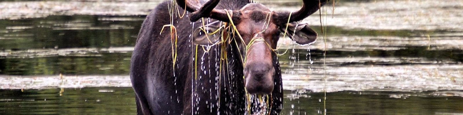
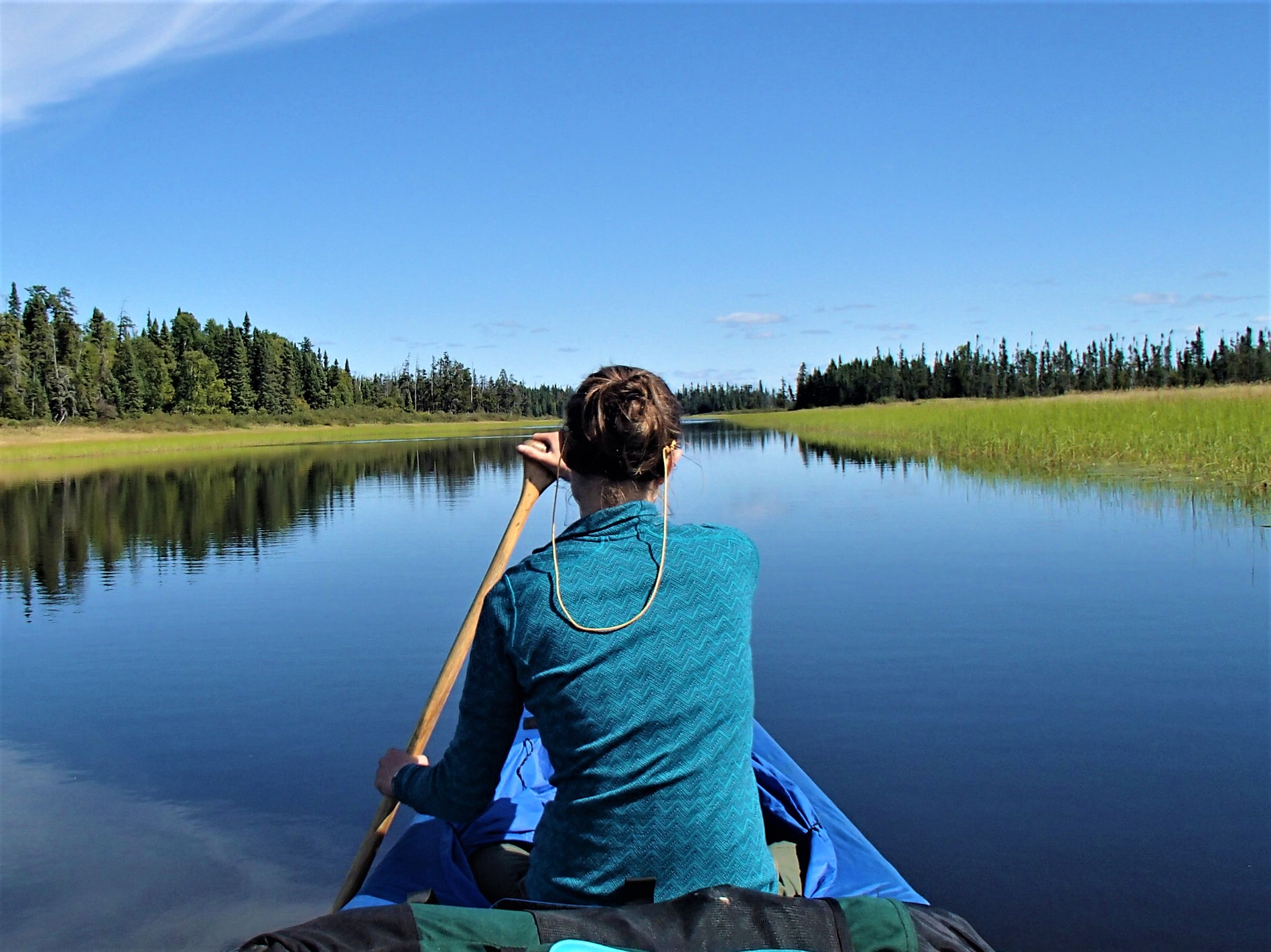
We started our trip around 9am on day one, after about a 35min drive from the town of Nakina. The first portage to the lake is long but easy. The sides of the trail where filled with blueberries, which were already long gone back in Minnesota. Our weather was overcast and cold, but fairly calm. We enjoyed paddling Marshall lake, and exited at the mouth of the Gripp River. The Gripp River is rocky and beautiful. We immediately started to see signs of the low water, as the river was rarely more than a few feet deep. In places we nearly ran out of water and had to push through thick vegetation.

Starting our trip
After a couple portages we approached Gripp Lake. We were met with a wall of wild rice and shallow water. We ended up pushing through to a small island and then carrying over it to get to open water.

Portages on the way to Gripp
We had a nice paddle down Gripp, and were treated to a few small patches of blue sky.

Paddling the Grip River
The section between Gripp and Summit proved challenging. Again we were dealing with sometimes mere inches of water, with a muck bottom. We frequently had to stand to see above the rice to decide our best course.
Once on Summit Lake we had a wide but weaving channel through the rice, which eventually opened up and allowed us to cross the lake to a campsite on the west shore. It was a very nice site, with lots of room to spread out.

Summit Lake Site
At around 12:30pm we were awakened by a flock of geese making as big a racket as they possibly could. They continued to do this throughout the night
The next day started with more shallow water. None of the rapids were runnable, but we were able to line and drag down some. By lunch we were at the falls on the Powitick. The falls were beautiful, but less impressive than they were in 2012.

Morning on Summit

Shallow water and beaver dams on the Powitick

Powitick Falls

The falls in 2012 with high water
Once we were on the Kap we had more water to deal with. All of the rapids still required lining or portaging. I had the old fall canoe trip chorus of “hey this would be fun to run in the spring” running through my head.
We tackled the last few portages, and made camp on the last portage before the bridge.

Camp on the portage
The next day was a long one. The Kap was wide, and there were no portages or rapids to negotiate. The day was fairly warm and sunny. During the day we decided not to try the Meta Creek route, and instead do the shorter loop. We ate lunch on a rock outcropping, and otherwise just paddled.

Paddling the Kap

Lunch on the Kap

Stewart Lake site
We made it to Stewart Lake around 3:30, and set up camp in a nice rocky bay. We enjoyed lounging around watching the sun go down. At night, I we discovered that one of our sleeping pads had popped. I was able to find and patch one small hole, but the pad continued to leak. I was able to sleep, but was a bit stiff getting up.
The wind had picked up the next day, and we had a strong head wind on Stewart. We made it to the small channel between Stewart and Stone, and again had shallow water to deal with. We waded a lot, and used one short portage.
Stone lake was full of whitecaps. We inched our way up the west shore to the campsite and ate lunch. We determined we were wind bound, and stayed the night. Having camped here in 2012 we knew it was a very nice site. We read and swam and kept ourselves occupied until bed time. I patched another hole in the mattress, but again only slowed the leak. I removed the foam padding from my pack and slept on that and some extra clothes and was comfortable and warm.

Stone Lake site

Relaxing on Stone Lake
We woke up at 5am and packed up to try and beat the wind for the Ara Lake crossing. The Stone to Ara port was a bit brushy, but so much easier than last time we did it, when it was so wet we would sink in to our waists. The wind was still light when we crossed Ara. At the point near the Arameta Channel we ate breakfast.

Paddling Ara

The final creek
Meta was hard going. The wind had picked up considerably, and we inched along. Once off the main part of the lake, we were able to make it about ¾ of the way up the creek to the last portage before it dried up. We carried along the edge of the creek until we hit a trail that eventually hit the main portage. The portage was dry and easy to follow. There were short sections of blow down, and some fairly brushy parts. I was pretty tired and took 5-6 breaks. Kate was less tired, and made sure the breaks were very short. We finished at the road and loaded up. We drove to Nakina to get some gas and snacks, and then headed towards Nipigon for the night. On the way out of Geraldton I was pulled over by a Conservation Officer who asked to see my crownland camping permits. Kate had them in her pocket, and we were on our way. Good to know that you can get checked.