
This Sept. I took a quick overnight on Crocodile Lake, starting at the Vegetable Chain and paddling back to E.Bearskin. Due to the birth of our daughter Molly this summer didn’t involve as much paddling as usual, and for the first time a while we didn’t take a longer Canadian trip. After getting the OK from Kate, I jumped at a chance to spend a night out.
I picked a short route, usually a nice day trip, and had a great relaxing trip. The weather was brisk but clear, and I had every lake I was on to myself.
 Vegetable Chain portage
 Approaching camp

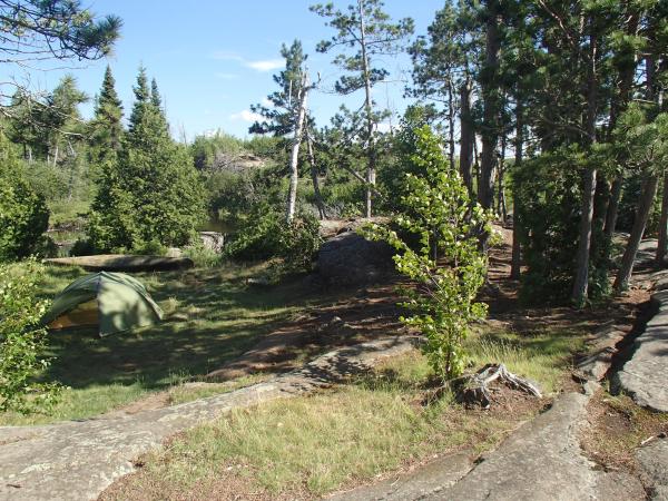
 All set up at camp
 Boiling water in the morning

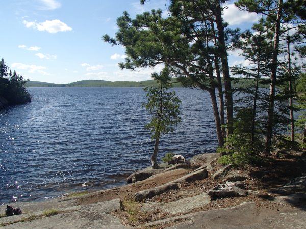
Stretching my legs on the paddle home
 Our annual canoe trip took us back to the Nakina region of Northern Ontario. Our initial plans were for a longer trip, but after seeing the water levels during the first part of the trip we decided to instead paddle the Marshall Lake Loop, which we had paddled in the spring of 2012. Our original plan would have taken us down the Lower Kap and up Meta Creek. We decided that the Lower Kap would be best enjoyed with more water, and Meta Creek could be a slog with no water.
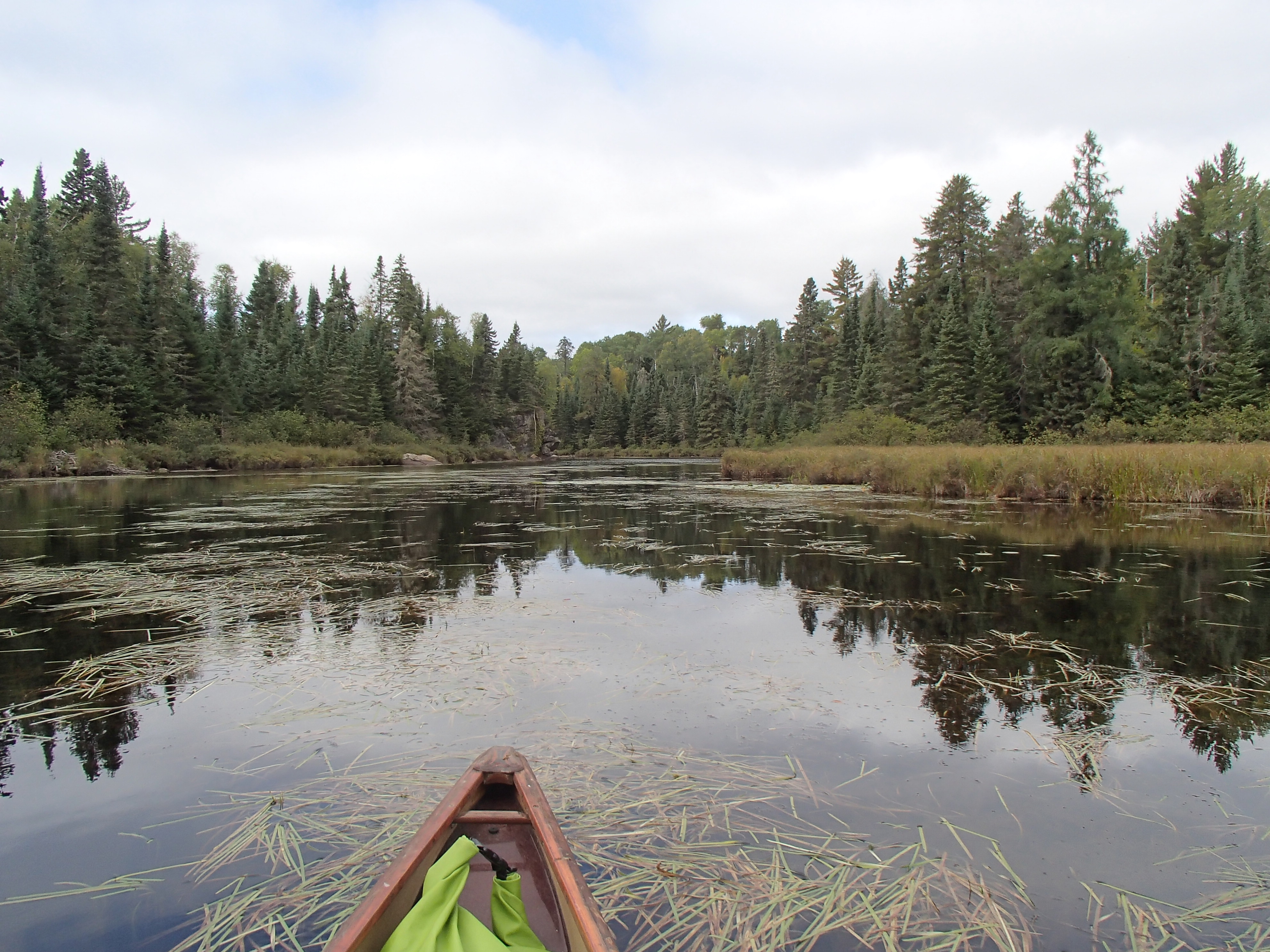
We started our trip around 9am on day one, after about a 35min drive from the town of Nakina. The first portage to the lake is long but easy. The sides of the trail where filled with blueberries, which were already long gone back in Minnesota. Our weather was overcast and cold, but fairly calm. We enjoyed paddling Marshall lake, and exited at the mouth of the Gripp River. The Gripp River is rocky and beautiful. We immediately started to see signs of the low water, as the river was rarely more than a few feet deep. In places we nearly ran out of water and had to push through thick vegetation.

Starting our trip
After a couple portages we approached Gripp Lake. We were met with a wall of wild rice and shallow water. We ended up pushing through to a small island and then carrying over it to get to open water.

Portages on the way to Gripp
We had a nice paddle down Gripp, and were treated to a few small patches of blue sky.

Paddling the Grip River
The section between Gripp and Summit proved challenging. Again we were dealing with sometimes mere inches of water, with a muck bottom. We frequently had to stand to see above the rice to decide our best course.
Once on Summit Lake we had a wide but weaving channel through the rice, which eventually opened up and allowed us to cross the lake to a campsite on the west shore. It was a very nice site, with lots of room to spread out.

Summit Lake Site
At around 12:30pm we were awakened by a flock of geese making as big a racket as they possibly could. They continued to do this throughout the night
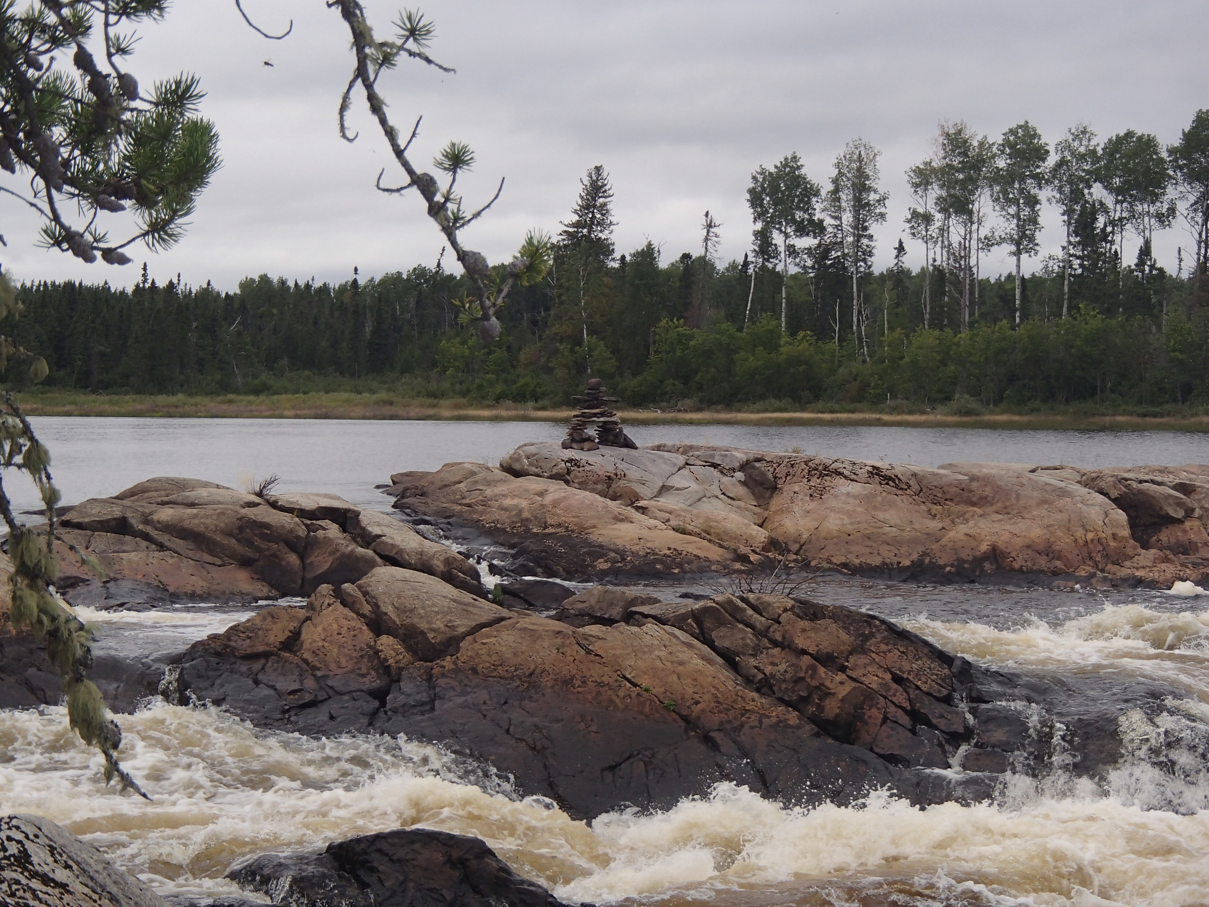
The next day started with more shallow water. None of the rapids were runnable, but we were able to line and drag down some. By lunch we were at the falls on the Powitick. The falls were beautiful, but less impressive than they were in 2012.

Morning on Summit

Shallow water and beaver dams on the Powitick

Powitick Falls

The falls in 2012 with high water
Once we were on the Kap we had more water to deal with. All of the rapids still required lining or portaging. I had the old fall canoe trip chorus of “hey this would be fun to run in the spring” running through my head.
We tackled the last few portages, and made camp on the last portage before the bridge.

Camp on the portage
The next day was a long one. The Kap was wide, and there were no portages or rapids to negotiate. The day was fairly warm and sunny. During the day we decided not to try the Meta Creek route, and instead do the shorter loop. We ate lunch on a rock outcropping, and otherwise just paddled.

Paddling the Kap

Lunch on the Kap

Stewart Lake site
We made it to Stewart Lake around 3:30, and set up camp in a nice rocky bay. We enjoyed lounging around watching the sun go down. At night, I we discovered that one of our sleeping pads had popped. I was able to find and patch one small hole, but the pad continued to leak. I was able to sleep, but was a bit stiff getting up.
The wind had picked up the next day, and we had a strong head wind on Stewart. We made it to the small channel between Stewart and Stone, and again had shallow water to deal with. We waded a lot, and used one short portage.
Stone lake was full of whitecaps. We inched our way up the west shore to the campsite and ate lunch. We determined we were wind bound, and stayed the night. Having camped here in 2012 we knew it was a very nice site. We read and swam and kept ourselves occupied until bed time. I patched another hole in the mattress, but again only slowed the leak. I removed the foam padding from my pack and slept on that and some extra clothes and was comfortable and warm.

Stone Lake site

Relaxing on Stone Lake
We woke up at 5am and packed up to try and beat the wind for the Ara Lake crossing. The Stone to Ara port was a bit brushy, but so much easier than last time we did it, when it was so wet we would sink in to our waists. The wind was still light when we crossed Ara. At the point near the Arameta Channel we ate breakfast.

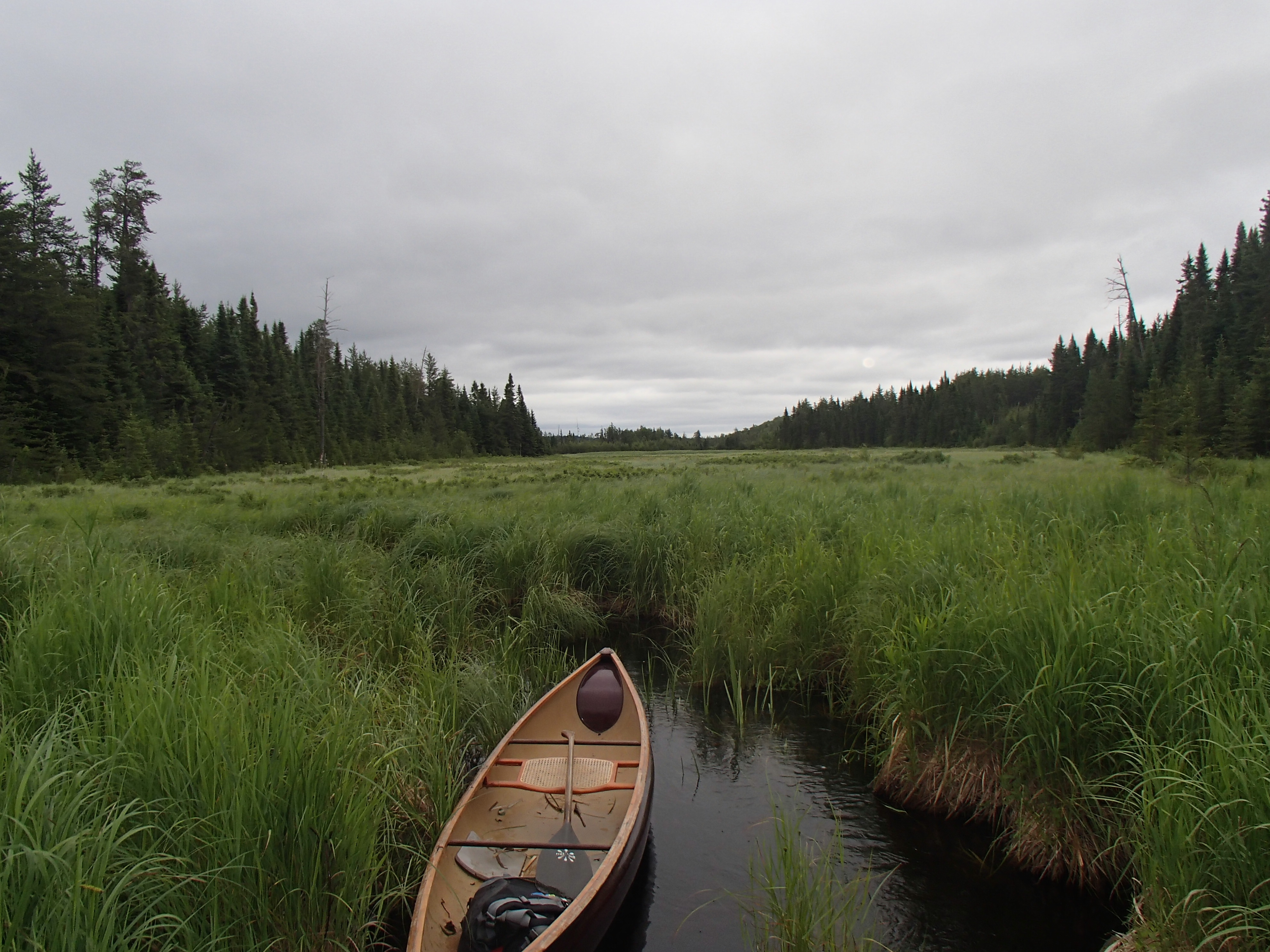
Paddling Ara

The final creek
Meta was hard going. The wind had picked up considerably, and we inched along. Once off the main part of the lake, we were able to make it about ¾ of the way up the creek to the last portage before it dried up. We carried along the edge of the creek until we hit a trail that eventually hit the main portage. The portage was dry and easy to follow. There were short sections of blow down, and some fairly brushy parts. I was pretty tired and took 5-6 breaks. Kate was less tired, and made sure the breaks were very short. We finished at the road and loaded up. We drove to Nakina to get some gas and snacks, and then headed towards Nipigon for the night. On the way out of Geraldton I was pulled over by a Conservation Officer who asked to see my crownland camping permits. Kate had them in her pocket, and we were on our way. Good to know that you can get checked.
This year Kate and I finally skied the full length of the Banadad Ski Trail. It’s been something we’ve been meaning to do for a long time, and has remained a stain on our resume of Gunflint Trail skiers.

The Banadad trail is a 27 km trail traveling through the BWCA. Unlike Bearskin’s ski trails it is a narrow single track trail, so classic skiing is the only option. The eastern end of the trail connects to the Lace Lake trail, a short 4k loop that then ties into Bearskin’s Poplar Creek trail, allowing us to start at the west end and ski home.
Most of the trail is fairly flat, with a few exciting hills in the middle section. The grooming was in great shape, and the weather was perfect.


Just past the half way point we stopped for a quick snack in a sunny opening at the bottom of one of the larger hills. It was evident from the tracks of other skiers that most of the traffic on the trail was starting at the east side.


snacks
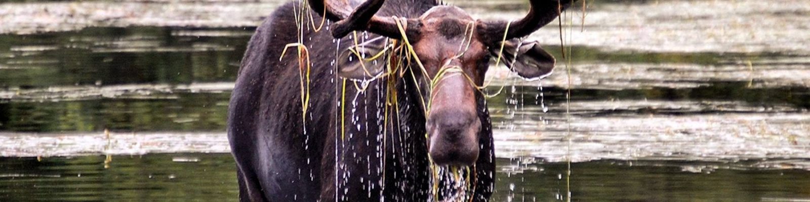
A short while after our snack break we entered a clearing and saw a moose staring back at us in the middle of the ski trail. We watched each other for a good while. It became apparent that the moose had no interest in moving. Turning around was not an option for us, so we tried politely reasoning with moose and scooted forward a bit. When we got closer 3 more moose revealed themselves, and we realized that we were simply going to have to wait. After a short wait the congregated moose decided that they had no more business to conduct on that section of trail, and headed on their way.

There’s a moose in there somewhere
We finished the trail, and took photos at the trail head. We hadn’t thought to do the same at the western trail head, so you’ll just have to believe us that we started there.


We skied the Lace Lake trail, and were reinvigorated once we hit Poplar Creek, one of our home trails. We made the harrowing descent of the gravel pit hill and were home.

Poplar Creek
It was a long day of skiing, and it felt good to be finished. The Banadad is certainly one of the most unique ski experiences in the Midwest, and a great adventure.
-Quinn
This year our annual trip to the Canadian Wilderness took us back to Nakina Ontario. Nakina is a paddling (and fishing) paradise with many wilderness route options ranging from whitewater rivers to huge scenic lakes. Despite this, it is rarely paddled.
Our last trip in the region had been filled with rain and moose. This year we had very little of either. Our route took us down 3 of the major waterways in the area (the Ogoki, Kap, and Little Current). After all that downriver, we had to somehow return to the road. The usual method involves a float plane. We choose to travel up the Esnagami River, and then crash through the woods to a logging cut which then accessed a road. For the entire trip there was a bit of uncertainty about this last stretch.
We set off on Aug. 28th. Our starting point required a somewhat lengthy shuttle from Nakina. Kate once again was a good sport and crammed in the back “seat” of my Tacoma to make room for our shuttle driver.
The Ottertail was a small river surrounded by low marshes. Our sky was overcast, and now and then we would feel a light drizzle.

Starting out on the Ottortail
Around lunch time we made it to the Ogoki River. The Ogoki at this point was similar to the Ottertail, but much wider. We stopped for lunch on a rare rock outcropping.

Lunch on the Ogoki
As we made our way down the Ogoki, the shoreline alternated between low marshes and rocky ridges. There was little to break up the day, and we made good time.
Our tentative plan was to shoot for Amy falls before making camp. The falls were spectacular. We landed on the shore opposite the portage to crawl around on the rocks and view the falls.

Amy Falls on the Ogoki

Portraits at Amy Falls

When we paddled across to the portage we met a group of three people. They were camped on the downstream side of the portage, and had come up the entire river over the last 40 days. In a motor boat! They were conducting a survey of river sturgeon, and were in the processes of preparing the portage to drag their boat across.
We talked to them for awhile, and then continued on our way. After another 5 miles, we found a flat rock next to a rapids to make camp on. We enjoyed a clear night, and had possibly my favorite animal encounter to date.

Ogoki Camp
The next day the Ogoki started to speed up. For much of the day we paddled easy but constant ripples and small rapids. The fast sections were separated by wide slow areas. The banks were mostly sandy, but the river was full of boulders.

Ogoki River
We made it to Ogoki Lake by around 3:30. Ogoki is a large lake, and a wind had come up. The terrain had changed to more typical Canadian Shield bedrock. We made camp on an island about a third of the way across the lake. It took a little work to make a tent pad, but we were able to find a flat area sheltered from the wind. During the night the wind picked up, and in the morning it had shifted. It was now coming out of the NW, which made for a confused crosswind for much of the remaining lake crossing.

Ogoki Lake

Ogoki Campsite
We set off in the wind, bobbing around in the large waves. About half way to the narrow section leading to Kayedon lake it started to rain. It was a fairly unpleasant crossing. Once we were on Kayedon we stopped to bundle up a bit more, and then paddled the lake. A float plane landed in front of us, and taxied over to the fly-in camp on the lake.

Kayedon Lake
A small stream runs into Kayedon on the southern shore. We poked our way up it towards the long portage to Kapikotongwa Lake. Eventually the stream became shallow, and it was easier just to line up it.

Creek out of Kayedon

Towing the canoe
At the end of the creek we paddled a small lake and then found the portage. The portage was in good shape, and fairly dry. Areas of the trail were full of cranberries. Up to this point in the trip we had done very little portaging, and my legs needed a wake up call as we made our way up the first hill. We took a couple of breaks, but made it across. We ate lunch on Kapikotongwa lake.

Kapikotongwa lake after a hearty lunch
The next run of lakes on the way to Briarcliffe were stunning examples of Canadian Shield. We found the portage to Briarcliffe, complete with a portage sign (thanks Rob!). We set up camp on a rock point on the west end of the lake. There was an on and off light drizzle, and a strong wind. As the sun went down, it was downright chilly.

Briarcliffe camp
The next morning the clouds cleared after breakfast, and we had what might have been our best day of the trip. The remaining lakes where my favorite of the trip, especially Saga Lake. The narrow waterways connecting them often had high rocky sides and small swifts.
We had some fun easy white water once we were on the main river section, as well as some small swifts. We made it to the first marked rapids at lunch. The rapids/falls was much larger than I expected. We ate our lunch on a rock island with the rapids roaring on either side of us.

Small rapids on the Kapikotongwa

Rapids on the Kapikotongwa

At this point, I realized that I had accidentally left our camera on in my pocket, draining most of the batteries. I became very judicious with its use in order to save batteries for the Little Current. Unfortunately that meant not documenting much of our most scenic day. Anyone wishing to see the lower Kapikotongwa will just have to paddle it themselves.
We did not find portages on the Kapikotongwa. I may have had wrong information, or they may have been covered with trees from a blowdown. We made our way down the first two large rapids through a combination of lining, carrying through the woods, and some paddling. It was slow going, but I was grateful to be at the rivers edge with the scenery, not back in the woods walking around it.
After scouting the third marked rapids, we determined we could run it. It was a little more ledgeish than we usually paddle, but we ran it without incident (because we are a lone canoe, in remote areas we are pretty conservative about what we run).
After a long section of swift water we made it to Percy lake. We camped on a small island with a high rock overlooking both the lake and river. That night we watched swirling northern lights.

Percy Lake camp
We paddled Percy lake the next morning, and hit the Little Current River. The river was wide to start. After a couple miles the current picked up and the shore became lined with gravel bars. We ate lunch on one in the middle of a swift section of water.

Little Current lunch
We paddled on, and came to Betty Falls. What a scenic area! We found a good portage around the falls, and then lined the rapids at the bottom. I took the last photo of the trip We carried on to Canyon Falls, which was spectacular. I had the portage marked on the left. After much searching we came up empty handed, and decided to paddle back up to Betty falls and camp rather than start the long process of lining down the river. We had a great campsite and swam and relaxed.

Betty Falls

Last photo of the trip
The next day we paddled back down to Canyon falls, and while preparing to line found a portage on the opposite side of the river. From here on we found good portages. Often they were short, and involved brief paddles to connect them. The river was full of constant current between the larger rapids and falls.
We made it to Louella Falls at lunch time and ate at the top of the portage. We were about to conclude our downstream potion of the trip.
The Esnagami was fast and shallow where it hit the Little Current. After paddling and wading for awhile, it became apparent that it was not going to slow down. I cut a 12′ spruce pole, and we started pushing upstream. We were able to make decent progress poling, every now and again needing to get out and wade very shallow parts. Kate kept the bow in the right direction while I poled.
We traveled about 5 hard miles in 3 hours, and made camp at the first (last) marked rapids. It was a lovely campsite. We swam and read, and both easily fell asleep.
The next day it was back to poling. In spots the river was deeper, and travel easier. For brief sections we could both paddle (for anyone interested, I had a gps on for this section. When paddling we moved at about 3.5 mph, poling 2.5mph, and wading 1.5mph. Roughly). We also had a few larger rapids to negotiate. At around 11 we made it to our take out point. Our take out involved a short bushwack to a logging cut where we would eventually hit a winter trail that would take us to the road. It worked, but not without a lot of wandering around in an overgrown cut. We eventually found our trail, and made it to the road. We found the truck another mile or so down the road and drove it as close as we could to the winter trail. We were very thankful that our shuttle driver had left a bottle of water in the cab.
We backtracked to the river, figuring out our best path on the way. We ate one more lunch on the river, and then started the long carry to the truck. We took a couple of breaks, but all in all it wasn’t as bad as we thought it would be. We loaded up and made our way back to Nakina. On the drive we saw our only two moose of the trip.
Overall it was a great trip. We saw a very varied landscape, and the Kapikotongwa and Little Current where probably the most scenic days of paddling I’ve experienced. Our last two days where by far the hardest I’ve worked on a canoe trip, but allowed us to see some beautiful remote country without needing a float plane pick up.
As a final thought: Would I recommend coming up the Esnagami, and exiting through the logging cut? Probably not. It worked for us, and I’m glad we did it, but even with perfect weather it took almost everything we had.
-Quinn
Growing up I had oftentimes heard stories of friends and family having incredible adventures at Isle Royale National Park. I have always desired to experience the island for myself and return with my own stories to share, and working at Bearskin this summer has allowed me to do so.
My aunt, a Grand Marais local and wonderful backpacking companion, agreed to join me on my Isle Royale adventure. On one of my days off, she and I packed our bags and headed to Grand Portage early in the morning to catch the ferry to Isle Royale. The weather for the ride was perfect; the water was like glass and the rising sun quickly warmed up the cold Superior air. The calm condition of the water allowed us to see the famous sunken steam ship “America” very clearly as we pulled into the Windigo port. My aunt and I quickly got our park permits and settled into a campsite, eager to hit the hiking trails.
We decided on hiking part of the Huginnin Cove Loop, a nice wooded trail where we were hoping to see some beautiful sights and maybe even a moose. The views on the hike were lovely and though we didn’t see a moose, it was very enjoyable to find hundreds of their tracks along the trail.
By the time we got back to our campsite we were looking forward to a big meal, and we soon found out that we weren’t the only ones. As I was cooking over the camp-stove, I heard some splashing coming from the little stream behind me. To my surprise, there was a moose coming down to the water right across from our site to join us for dinner. We watched her munch on plants along the shoreline for a good 15 minutes before she swam right over to our campsite and trotted off into the woods just a few yards away from us! It was the most amazing moose experience either of us had ever had.
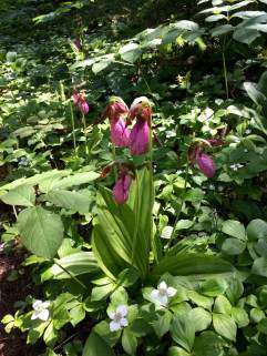
The next morning we were ready to take on more hiking adventures. We chose to do the Grace Creek Overlook trail along the lake because it got hotter and buggier the further inland we went. Walking along the water allowed us to watch boats and sea planes come into and out of the Windigo harbor and it also provided the perfect habitat for Lady Slippers–we must have counted over 50 of them along the trail!
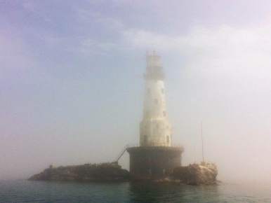
After we finished our hike, we packed up our bags and headed to the boat for our journey back. The weather was very overcast, creating an eerie sight as we passed by the Rock of Ages Lighthouse which was barely visible through the fog.

Before we knew it, we were back at Grand Portage and on our way home, excited to share our own new stories about Isle Royale. It was an amazing experience and I would definitely recommend the trip to anyone looking for a unique adventure.
Maddie

This week Kate and I took a quick overnight trip starting at Round lake, and looping through Gabimichigami. We had great weather, and shockingly, saw very few people. Our route had us portage into W.Round lake, and head towards Brandt lake from Brandt we portaged to Flying, and then Fay lake. Water is very high in this area, and the portage to Fay involved long stretches of knee to waist deep water. I had been over that portage in June, and it was much drier. I suspect there is a beaver to blame somewhere. From Fay it was on to the Chub river and Warclub lake. I was eager for this section, since neither of us had paddled the area between the Chub River and Peter lake. We ate lunch on Warclub, and had our fill of blueberries. Next was Seahorse lake, one of my favorite lakes of the trip, with high rocks and sprawling bays.


Once we portaged into French lake, and then Peter, we were done with the small lake portion of the trip. Like all of the lakes so far, Peter was burned, and didn’t look like it offered great camping. From Peter we portaged to Gabi, our destination for the day.
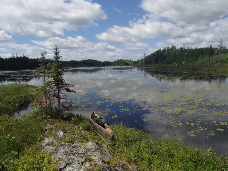
Gabi is a large expanse of water, and with the exception of the south bay, unbroken by islands or peninsulas. We found a nice campsite and made our home for the night. We swam and looked for berries, before eating dinner and going to bed.
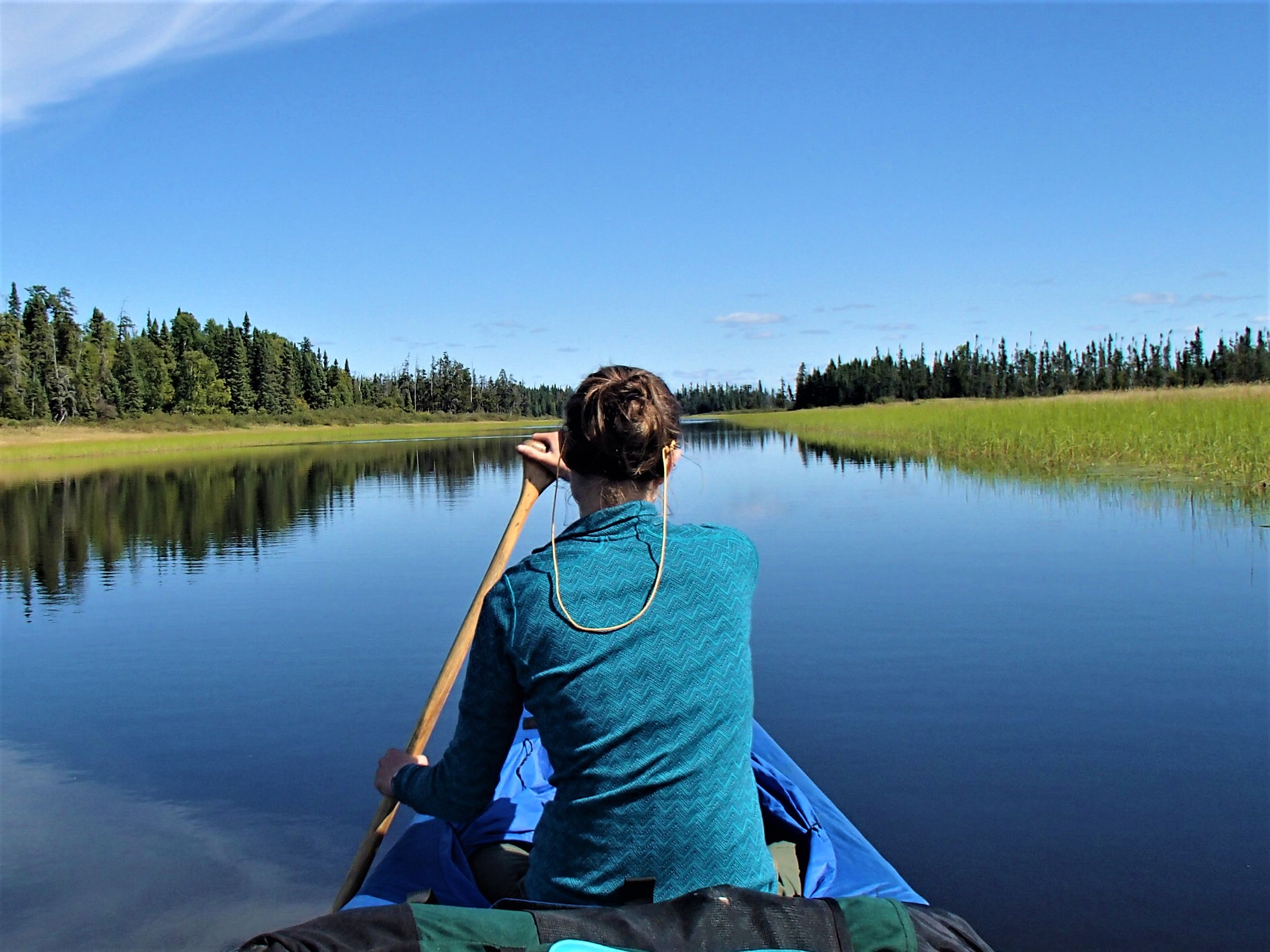
The next morning it was a treat to have fresh blueberries in our granola! We were on the water by 8:30, and made our way through Rattle lake to Little Sag. Little Sag is a pleasure to paddle, and we wove between its islands as we made our way towards Mora lake. We’ve always enjoyed the portage to Mora, with its great views of the last drop of the Frost River.

From Mora we paddled Tarry, Crooked and Owl lakes. On Crooked we watched a Loon feeding its young. We portaged to Tuscarora lake, and paddled to an island to swim and eat lunch. The day had become very warm, and it was nice to find some refuge in the shade.
We finished lunch, and made our way to the long portage out of Tusc. Despite my love of the Howl Swamp portage, we choose the more direct route to Missing Link lake. The portage was long and hot. There was an abundance of frogs on the Missing Link side, many still with tales. We paddled Missing Link and returned to Round Lake. On the drive home we bemoaned the lack of a functioning air conditioner in my truck.
It felt so great to get out over night in the middle of the season. We were very lucky in regards to the weather and the solitude.
Quinn
I have, on a few occasions, tried to access Nighthawk lake from the small flowage to the east of the lake. I have always enjoyed overlooking the lake in the winter from the Poplar Creek ski trail. As the planted white pines surrounding the ski trail grow larger it’s possible that in a few years the view of the lake will be diminished, and without a reminder every time I ski or groom by, my curiosity about the lake will wane as well.
My previous attempts at getting to Nighthawk have failed due to lack of time, lack of water, or lack of heart. Most of the marsh between the creek and lake sits firmly in the middle ground between land and water, where neither paddling or walking is possible. It is impossible to not become covered in mud, and the bugs are ferocious.
This time I gave myself plenty of time. Our water is fairly high. After a few hours of pushing and dragging through through the swamp, I was able to crash through the woods to the small beaver pond down stream of the lake. One more climb over a beaver dam, and I had done it! A paddle around Nighthawk revealed it to be a small nondescript lake.
I determined that it would be much easier to simply portage back to my truck on the ski trail. In around twenty minutes I was loading up my canoe.

Poplar creek is on the right, Nighthawk the left.

The yellow is the “paddling” portion, the orange the walk on the ski trail.

Leaving the main creek

Less water already

The Swamp

At the other side of the Swamp.

Almost to the beaver pond

Nighthawk at last
In summary: Is it possible to get to Nighthawk lake from Poplar Creek? Sort off. Should you try it? No.
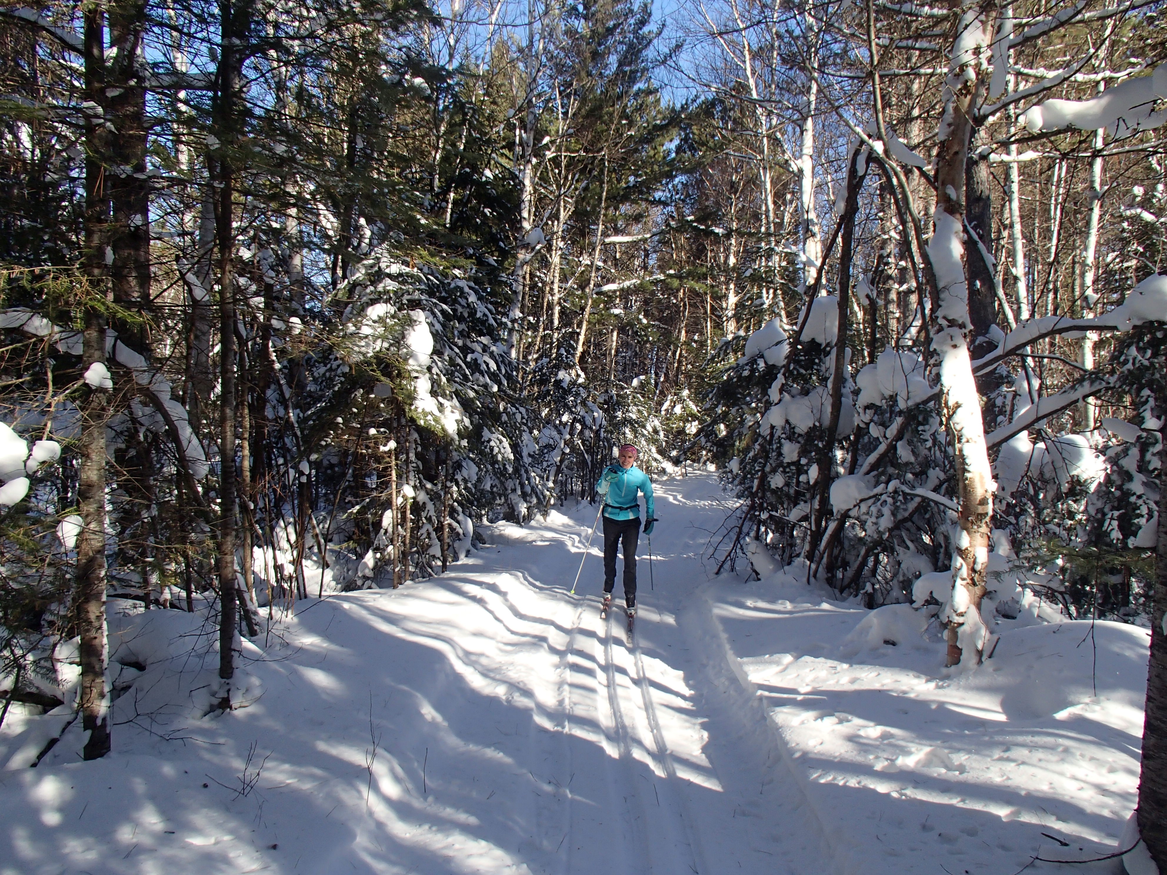
Last Tuesday I headed up to Round lake to visit with a couple friends up the trail. Round Lake is the home of Tuscarora Outfitters, now owned by former Bearskin mainstay Andy. Andy has more spare time in the winter these days and is making the most of it.
From Round I strapped on the skis and headed a few miles into the BWCA to find Bear from Northstar Canoes. He’s made the BWCA his winter home since the New Year, and it was great catching up and seeing his setup.
It was a beautiful day, and I was blown away by the difference in these lakes in the winter season. Gotter Lake is beautiful? Who knew. Skiing with only a pack on my back, instead of a canoe and gear, made the rapid succession of portages enjoyable. The contrast of dark rock and white snow exposed cliff faces that would go unnoticed in the summer.


I didn’t get any photos of Bear’s camp, because I forgot. And I didn’t get any of Andy, because I didn’t want to risk breaking an expensive camera.
-Quinn
As the planning begins for the 2016 Boundary Waters Expo, I thought I’d give a recap of this year’s inaugural event.
The Boundary Waters Expo was held at the Seagull Public Landing in mid June. It was highlighted by expert speakers, knowledgeable exhibitors, beautiful canoes, good friends, and perfect weather. We had a nice turnout of around 200-300 people, enough to fill the presentations but not so many that you couldn’t get one-on-one time with the speakers. While the event took a lot of time and effort to get together, in the end I thought it was a great success.
For info on the 2016 show, go to The Boundary Waters Expo or find us on Facebook.
Our 2015 Sponsors:
Camp Chow
Duluth Pack
Enlightened Equipment
Friends of the Boundary Waters Wilderness
Frost River
St. Croix Canoes
The Campaign to Save the Boundary Waters
Stewart River Boatworks
Nemo Equipment
Seattle Sports
Sealskinz
Cooke Custom Sewing
Sanborn Canoe Company
Northstar Canoes
Nova Craft Canoe
Souris River Canoes
Radiant Spirit Gallery

The Gunflint Trail booth was front and center in the big tent.

Tom from Loon Lake will talk your ear off!

We had boats to demo from Nova Craft

Northstar Canoes

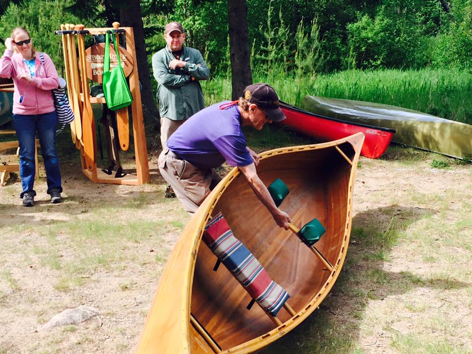
Stewart River Boatworks

St.Croix Canoes and (not pictured) Souris River.

Nemo Equipment brought a variety of tents and other innovative equipment

The Gunflint Trail’s own Camp Chow was at the show with their wonderful camping meals.

Eric Simula, Bearskin’s musher, presented about building bark canoes.

A highlight was personal paddling instruction from canoe legend Cliff Jacobson.
Cliff has agreed to be available for lessons throughout the entire expo next year.

Cliff also demonstrated portaging and gave a few tips.

Dan Cooke showed everyone how to rig a tarp. Watch out Dan, someone is sneaking up behind you!

The landing was full of great places for speakers to give their presentations.

Patti Johnson of the USFS arrived in style in a Forest Service Beaver. The pilot happily gave spectators a tour of his plane.

Voyageur Brewing Company stopped by and gave out free samples

.
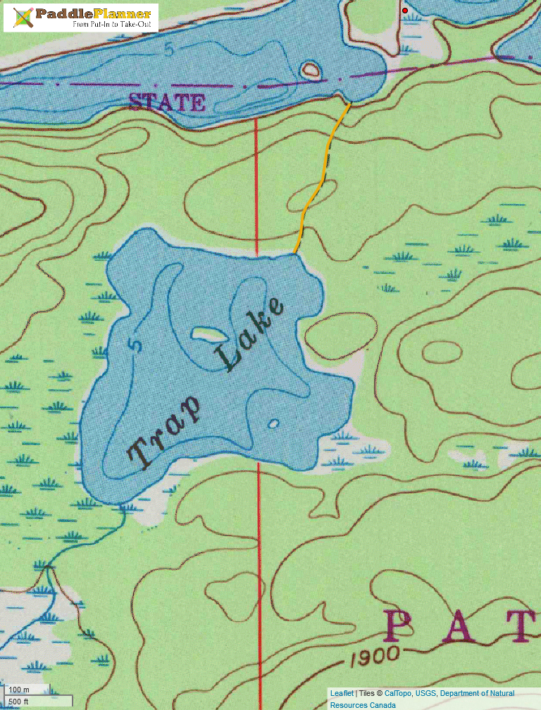

Trap lake is a small, very shallow lake located south or Crocodile Lake. From the water there is no sign of the marked 73 rod portage, and many people assume that it doesn’t exist. After all, there is really no reason to go there, the lake has no campsites and can’t be much for fishing. When I’ve been asked if I’ve been there, the question is usually followed by a chuckle.
72 rods of the portage from Crocodile to Trap are fairly obvious and easy to follow, it’s the first rod that makes it hard. The portage starts up what is essentially a small cliff. From the water one would never assume that it was the start of a trail, and because it seems so little used, there is minimal evidence that it is one.
In the winter of 2009 I set out to camp on Trap Lake. During the winter you are free to camp away from designated campsites in the BWCA, meaning it is the only time of year where camping on Trap is possible. I had been up on Crocodile earlier in the winter, and thought I had located the portage. Bob skied with me to portage to Trap, and then left me to haul my sled up the steep portion of trail. Once on top I was greeted with a clear trail, covered in a couple feet of untouched snow. The following snowshoe was challenging, but beautiful.
I made camp on the small island in the middle of the lake. I built a small fire at the base of a large rock, and packed a flat space to set up my tarp above. The next morning it was easy traveling on my packed trail back to Bearskin. The next summer I returned to Trap Lake twice by canoe, once with Bob and once with Kate.
-Quinn

Trap Lake in 2009
My visit to trap lake in August of 2015 was inspired by my co-worker/explorer, Jordan, who after spotting it on a map, became curious. Having spent a fair amount of time paddling and portaging in Canada’s wilderness, Jordan had a special place in his heart for the overgrown and unmanageable terrain that this trip offered. Jordan and I collected info from Bob and Quinn and set out after work one evening. It was a lovely night and smooth paddling down E. Bearskin Lake and the portage to Crocodile.
It was only after wandering back and forth down the south shore of Crocodile that we finally found the sheer cliff we were told marked the beginning of this portage. I must admit that with two strong men, minimal gear, and some teamwork, we were able to easily ascend this first challenge. What followed proved to be just as adventurous. The “trail” was evident, yet overgrown from an obvious lack of use. I wondered out loud to Jordan whether the last visitors were Quinn and Kate in 2009. Feeling inspired, Jordan heaved the 60 lb Aluminum Canoe over his head and began his bush-wack adventure. I could tell he was in his element when he dropped to his knees and steadily portaged the canoe under a fallen ash that blocked the non-existent trail. This was only bested by his scrambling over boulders while barely hesitating to maintain perfect balance. We eventually arrived at Trap Lake, and Jordan introduced me to the concept of a “portage high,” informing me of this natural state of euphoria following a grueling feat of physical endurance.


Trap Lake was worth the trip. The value, however was both in the destination and the journey. The shallow, lily-pad infested lake felt fantastically otherworldly and was a just reward for our efforts. I took my turn to portage the canoe on the return trip, while only managing to fall once. The experience of a “portage high” was everything Jordan talked it up to be.
-Matthew